|
search place name
|
||
Alisos (Piura, Peru)Alisos is a town in the Piura region of Peru. An overview map of the region around Alisos is displayed below.
regional and 3d topo map of Alisos, Peru ::

Alisos airports ::
The nearest airport is PIU - Piura Capitan Fap Guillermo Concha Iberico, located 90.6 km south west of Alisos.
Other airports nearby include TBP - Tumbes Pedro Canga (145.6 km north), TYL - Talara Capitan Montes (150.1 km west), MCH - Machala General Manuel Serrano (167.5 km north), CUE - Cuenca Mariscal Lamar (233.6 km north east), Nearby towns ::
Yangas (4.1km north west) //
San Juan (4.1km north east) //
Pillo (5.6km north) //
Cachiris (5.9km south) //
Arrendamientos (6.7km south east) //
Sapillica (7.4km west) //
Naranjo (7.6km east) //
Cacaturo (8.3km north west) //
Lagunas (8.3km north west) //
Raccho (8.3km south east) //
Naranjo (9.2km south west) //
Palo Blanco (10.5km south west) //
[all distances 'as the bird flies' and approximate] 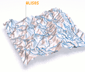 Places with similar names to Alisos, Peru ::
// Al Sasso (CH)
// Alsos (NO)
// Alačići (BA)
// Aličići (BA)
// Ališići (BA)
// Alisos (MX)
// Alissas (FR)
// Al ‘Azīz (IQ)
// Al ‘Azāyzah (EG)
// Al ‘Azīzah (EG)
Disclaimer :: Information on this page comes without warranty of any kind |
||
|
Where is Alisos? Elevation and coordinates ::
Latitude (lat): 4°47'0"S Longitude (lon): 79°55'0"W
Elevation (approx.): 2905m (map arrows pan, magnifying glasses zoom) |
||
|
Visiting Alisos? Hotel/Accommodation ::
Book a hotel in Alisos Travel Guide ::
Buy a travel guide for Peru rental cars ::
car rental offers GPS waypoint ::
download a GPX waypoint (PoI) of Alisos for your GPS receiver
|
||