|
search place name
|
||
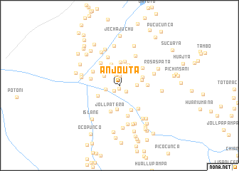
Anjo Uta (Puno, Peru)Anjo Uta is a town in the Puno region of Peru. An overview map of the region around Anjo Uta is displayed below.
regional and 3d topo map of Anjo Uta, Peru ::
Anjo Uta airports ::
The nearest airport is JUL - Juliaca, located 124.0 km south of Anjo Uta.
Other airports nearby include PEM - Puerto Maldonado Padre Aldamiz (208.7 km north), AQP - Arequipa Rodriguez Ballon (280.9 km south west), Nearby towns ::
Chimpa Pata (0.6km south) //
Sillacunca (1.2km south west) //
Huacacancha (1.4km south east) //
Chilliutera (1.5km north) //
Urapata (1.7km north) //
Cebadacancha (2.1km north) //
Curu Pata (2.2km west) //
Jollpatera (2.7km north west) //
Jollpajuchu (2.7km east) //
Chijuruni (2.7km north west) //
Jena Pampa (3.5km north east) //
Puquine (3.5km north) //
Unanojane (3.6km north) //
Huaraj Pampa (3.5km east) //
Yorac Cancha (3.7km south west) //
Chilliutera (3.8km south) //
Laipiña (3.8km north) //
Samincurani (3.8km east) //
Chijulani Munay Pata (4.3km south east) //
Jollpatera (4.3km south) //
Tojlla Pampa (4.3km east) //
Pata Laime (4.5km north east) //
Alcamarine (4.5km north west) //
Huata Pampa (4.5km west) //
Incacancha (4.7km south east) //
Jullmani (4.6km north west) //
Ojo Huayjo (4.8km north) //
Misquini (4.9km south) //
Jehuita (5.3km north east) //
[all distances 'as the bird flies' and approximate] 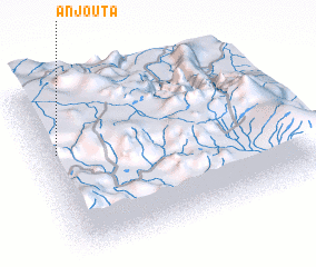 Places with similar names to Anjo Uta, Peru ::
Disclaimer :: Information on this page comes without warranty of any kind |
||
|
Where is Anjo Uta? Elevation and coordinates ::
Latitude (lat): 14°22'2"S Longitude (lon): 69°56'18"W
Elevation (approx.): 4246m (map arrows pan, magnifying glasses zoom) |
||
|
Visiting Anjo Uta? Hotel/Accommodation ::
Book a hotel in Anjo Uta Travel Guide ::
Buy a travel guide for Peru rental cars ::
car rental offers GPS waypoint ::
download a GPX waypoint (PoI) of Anjo Uta for your GPS receiver
|
||