|
search place name
|
||
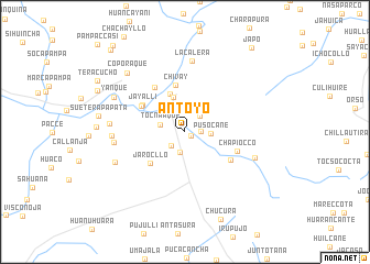
Antoyo (Arequipa, Peru)Antoyo is a town in the Arequipa region of Peru. An overview map of the region around Antoyo is displayed below.
regional and 3d topo map of Antoyo, Peru ::
Antoyo airports ::
The nearest airport is AQP - Arequipa Rodriguez Ballon, located 73.1 km south of Antoyo.
Other airports nearby include JUL - Juliaca (155.7 km east), ANS - Andahuaylas (289.0 km north west), Nearby towns ::
Tola Pata (0.7km south east) //
Chilluyo (1.5km east) //
Lima Cota (2.0km south west) //
Japo (2.1km south) //
Tambo (2.2km north east) //
Tocna Aque (2.5km west) //
Pusocane (2.5km east) //
Escalera (2.8km north) //
Yuracmocco (3.7km north) //
Trapiche (3.7km north west) //
San Andres (4.1km north) //
Jarocllo (4.7km south west) //
Chivay (4.8km north) //
Jayalli (4.9km north west) //
Pulpera Huayjo (5.0km north west) //
Huanta Occo (5.3km south east) //
Canayaque (5.5km north west) //
Chapiocco (5.5km east) //
La Calera (7.3km north) //
Cullujane (7.0km west) //
El Molino (7.2km west) //
Huarancante (7.3km east) //
Humajala (7.5km south west) //
Senja Pata (7.5km west) //
Yanque (7.8km north west) //
Coporaque (8.2km north west) //
Sueterapa Pata (8.6km west) //
Chucura (9.5km south) //
Hupana (9.5km north west) //
[all distances 'as the bird flies' and approximate]  Places with similar names to Antoyo, Peru ::
Disclaimer :: Information on this page comes without warranty of any kind |
||
|
Where is Antoyo? Elevation and coordinates ::
Latitude (lat): 15°40'50"S Longitude (lon): 71°35'35"W
Elevation (approx.): 4120m (map arrows pan, magnifying glasses zoom) |
||
|
Visiting Antoyo? Hotel/Accommodation ::
Book a hotel in Antoyo Travel Guide ::
Buy a travel guide for Peru rental cars ::
car rental offers GPS waypoint ::
download a GPX waypoint (PoI) of Antoyo for your GPS receiver
|
||