|
search place name
|
||
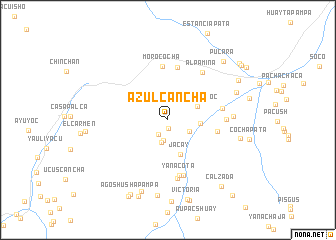
Azulcancha (Junín, Peru)Azulcancha is a town in the Junín region of Peru. An overview map of the region around Azulcancha is displayed below.
regional and 3d topo map of Azulcancha, Peru ::
Azulcancha airports ::
The nearest airport is LIM - Lima Jorge Chavez Intl, located 114.1 km west of Azulcancha.
Other airports nearby include AYP - Ayacucho Coronel Fap Alfredo Mendivil Duarte (267.7 km south east), Nearby towns ::
Esquina Corral (0.9km south) //
Cunyac (1.9km south west) //
Huarmicocha (2.4km south) //
Magdalena (2.6km south) //
Yanama (2.7km south east) //
Vicharrayoc (3.5km north east) //
Cashapata (3.6km east) //
Jacay (4.0km south) //
Yauli (5.5km east) //
Tucta (6.0km north) //
Morococha (6.0km north) //
Luichupata (6.1km east) //
Yanacota (6.3km south) //
Jaillina (6.4km south) //
Alpamina (6.5km north east) //
Mesapata (6.4km east) //
Ticlie (6.6km south) //
Llanopampa (7.1km east) //
Los Amos de Yauli (8.1km east) //
Condorcancha (8.2km east) //
Agocancha (8.5km south) //
Shugumpi (8.5km south) //
Batiapampa (8.9km north east) //
Pucará (9.0km north east) //
Victoria (9.1km south) //
Shuyupata (9.2km south) //
Agoshusha Pampa (9.3km south west) //
Calzada (9.4km south east) //
Shipunahuain (9.6km south west) //
[all distances 'as the bird flies' and approximate]  Places with similar names to Azulcancha, Peru :: Disclaimer :: Information on this page comes without warranty of any kind |
||
|
Where is Azulcancha? Elevation and coordinates ::
Latitude (lat): 11°39'13"S Longitude (lon): 76°8'9"W
Elevation (approx.): 4622m (map arrows pan, magnifying glasses zoom) |
||
|
Visiting Azulcancha? Hotel/Accommodation ::
Book a hotel in Azulcancha Travel Guide ::
Buy a travel guide for Peru rental cars ::
car rental offers GPS waypoint ::
download a GPX waypoint (PoI) of Azulcancha for your GPS receiver
|
||