|
search place name
|
||
Capillacata (Arequipa, Peru)Capillacata is a town in the Arequipa region of Peru. An overview map of the region around Capillacata is displayed below.
regional and 3d topo map of Capillacata, Peru ::

Capillacata airports ::
The nearest airport is AQP - Arequipa Rodriguez Ballon, located 136.4 km south of Capillacata.
Other airports nearby include JUL - Juliaca (149.1 km east), CUZ - Cuzco Teniente Alejandro Velasco Astete Intl (180.8 km north), ANS - Andahuaylas (253.2 km north west), Nearby towns ::
Paccohuarmi (1.2km north) //
Hichoccollo (1.2km west) //
Arosita (1.6km east) //
Humaracce (2.2km west) //
Cercomayo (2.7km north) //
Huilayacce (2.9km west) //
Jayunuma (3.1km north) //
Ccotaocco (3.0km east) //
Achumane (3.5km east) //
Quisini (4.5km south) //
Caracollo (4.5km north east) //
Machacuyo (4.6km west) //
Ccascca (5.1km south east) //
Llapallapa (5.3km south) //
Cacamayo (5.8km north west) //
Japo (5.8km south west) //
Suyckutamo (6.0km north east) //
Puro Puro (6.2km north) //
Tantaña (6.1km west) //
Achupallane (6.3km south west) //
Quicomarca (6.6km south east) //
Coya Coya (6.7km north east) //
Huiluma (6.8km north east) //
Parani (6.7km east) //
Pallulluyo (6.9km south east) //
Huayllohuma (6.9km north west) //
Lluncuyo (6.9km north west) //
Patillane (7.0km north west) //
Pacra (7.0km east) //
[all distances 'as the bird flies' and approximate] 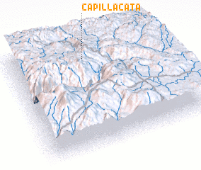 Places with similar names to Capillacata, Peru ::
// Cape Lookout (US)
Disclaimer :: Information on this page comes without warranty of any kind |
||
|
Where is Capillacata? Elevation and coordinates ::
Latitude (lat): 15°6'42"S Longitude (lon): 71°29'49"W
Elevation (approx.): 4424m (map arrows pan, magnifying glasses zoom) |
||
|
Visiting Capillacata? Hotel/Accommodation ::
Book a hotel in Capillacata Travel Guide ::
Buy a travel guide for Peru rental cars ::
car rental offers GPS waypoint ::
download a GPX waypoint (PoI) of Capillacata for your GPS receiver
|
||