|
search place name
|
||
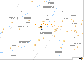
Ccaccamarca (Ica, Peru)Ccaccamarca is a town in the Ica region of Peru. An overview map of the region around Ccaccamarca is displayed below.
regional and 3d topo map of Ccaccamarca, Peru ::
Ccaccamarca airports ::
The nearest airport is PIO - Pisco Intl, located 109.0 km west of Ccaccamarca.
Other airports nearby include AYP - Ayacucho Coronel Fap Alfredo Mendivil Duarte (151.1 km north east), ANS - Andahuaylas (209.9 km east), Nearby towns ::
San José de Curis (1.3km west) //
Puquio (1.7km north west) //
Lluco (3.2km south west) //
Querco Cancha (3.3km south east) //
Molle Chacra (3.6km south) //
Jajacancha (3.7km north) //
Macchanga (3.8km north) //
Duraznuyoc (4.7km south) //
San Isidro (4.7km south east) //
Marcalla (4.8km south west) //
Jatun Puquio (4.9km east) //
Huancamayo (5.3km north east) //
Tambo Cruz (5.5km north) //
Ñahuinya (5.4km north west) //
Mayochimpana (5.7km south) //
Paclapata (5.6km east) //
Cochanca Chico (5.6km east) //
Huaman Marca (5.8km east) //
Patahuasi (6.2km south east) //
Contejasa (6.1km east) //
Huerta Chayoc (6.6km north east) //
Ticcra (6.6km east) //
Vista Alegre (6.8km south west) //
Huancariso (7.0km north west) //
Gallo Rumi (7.3km south west) //
San Isidro de Curis (7.6km south west) //
Huambo (7.4km east) //
Córdova (8.2km east) //
Tambo Cancha (8.3km west) //
[all distances 'as the bird flies' and approximate]  Places with similar names to Ccaccamarca, Peru :: Disclaimer :: Information on this page comes without warranty of any kind |
||
|
Where is Ccaccamarca? Elevation and coordinates ::
Latitude (lat): 14°2'54"S Longitude (lon): 75°15'38"W
Elevation (approx.): 2974m (map arrows pan, magnifying glasses zoom) |
||
|
Visiting Ccaccamarca? Hotel/Accommodation ::
Book a hotel in Ccaccamarca Travel Guide ::
Buy a travel guide for Peru rental cars ::
car rental offers GPS waypoint ::
download a GPX waypoint (PoI) of Ccaccamarca for your GPS receiver
|
||