|
search place name
|
||
Ccotanani (Puno, Peru)Ccotanani is a town in the Puno region of Peru. An overview map of the region around Ccotanani is displayed below.
regional and 3d topo map of Ccotanani, Peru ::

Ccotanani airports ::
The nearest airport is JUL - Juliaca, located 154.4 km south of Ccotanani.
Other airports nearby include PEM - Puerto Maldonado Padre Aldamiz (178.8 km north east), Nearby towns ::
Pusca (0.8km south) //
Ccasacucho (1.9km south east) //
Jacantara (3.0km south east) //
Ccasanchaya (3.6km south) //
Ucanuma (3.8km south east) //
Santa Ana (3.9km south east) //
Occosiri (3.9km south west) //
Churunpata (4.1km south) //
Patatiana (4.4km north) //
Jatun Pucana (4.5km north west) //
Chuna (4.9km west) //
Chitipia (5.2km south west) //
Surupata (6.0km south west) //
Huancarane (6.2km north) //
Chivillo Cancha (6.3km south) //
Carapatico (6.5km south) //
Pucana (7.3km north west) //
Coetapalo (7.4km south west) //
Moroncoasa (7.4km south east) //
Queño Huani Huacta (7.4km south west) //
Solimano (7.7km south west) //
Cusqui (7.7km south east) //
Osculloni (7.7km west) //
Pellana Cancha (8.0km south west) //
Cusquipampa (8.1km south east) //
Ccompo (8.2km east) //
Rosapata (9.1km east) //
Janca (9.5km south west) //
Pacacorral (10.3km south east) //
[all distances 'as the bird flies' and approximate] 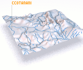 Places with similar names to Ccotanani, Peru :: Disclaimer :: Information on this page comes without warranty of any kind |
||
|
Where is Ccotanani? Elevation and coordinates ::
Latitude (lat): 14°5'54"S Longitude (lon): 69°52'50"W
Elevation (approx.): 3650m (map arrows pan, magnifying glasses zoom) |
||
|
Visiting Ccotanani? Hotel/Accommodation ::
Book a hotel in Ccotanani Travel Guide ::
Buy a travel guide for Peru rental cars ::
car rental offers GPS waypoint ::
download a GPX waypoint (PoI) of Ccotanani for your GPS receiver
|
||