|
search place name
|
||
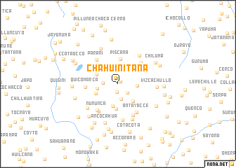
Chahuinitaña (Arequipa, Peru)Chahuinitaña is a town in the Arequipa region of Peru. An overview map of the region around Chahuinitaña is displayed below.
regional and 3d topo map of Chahuinitaña, Peru ::
Chahuinitaña airports ::
The nearest airport is AQP - Arequipa Rodriguez Ballon, located 133.6 km south of Chahuinitaña.
Other airports nearby include JUL - Juliaca (138.5 km east), CUZ - Cuzco Teniente Alejandro Velasco Astete Intl (187.2 km north), ANS - Andahuaylas (263.4 km north west), Nearby towns ::
Antune (0.5km north east) //
Pucrutaña (1.3km south) //
Carachuyoc (2.0km south east) //
Llapallapa (2.3km west) //
Quenco (2.4km south) //
Pajrapampa (2.8km north west) //
Chuncho (3.0km east) //
Chicoro (3.3km west) //
Ccocha (3.6km south east) //
Antune (3.6km south) //
Pacra (3.7km north west) //
Carihuito (3.7km south west) //
Ampato (4.0km south) //
Piscaña (4.0km north) //
Yanacahua (4.8km north east) //
Parani (5.0km north west) //
Quicomarca (5.0km west) //
Ñuñunca (5.2km south west) //
Fichañuyo (5.2km south west) //
Antayacce (5.4km south east) //
Accopiñata (5.5km south east) //
Jachuma (5.6km north east) //
Lluscallusca (5.8km south) //
Huarjia (6.1km south) //
Llacto (6.1km south west) //
Vizcachullo (6.0km east) //
Pillune (6.2km north west) //
Ancocahua (6.5km south) //
Chiluma (6.7km north east) //
[all distances 'as the bird flies' and approximate]  Places with similar names to Chahuinitaña, Peru :: Disclaimer :: Information on this page comes without warranty of any kind |
||
|
Where is Chahuinitaña? Elevation and coordinates ::
Latitude (lat): 15°8'45"S Longitude (lon): 71°24'15"W
Elevation (approx.): 4474m (map arrows pan, magnifying glasses zoom) |
||
|
Visiting Chahuinitaña? Hotel/Accommodation ::
Book a hotel in Chahuinitaña Travel Guide ::
Buy a travel guide for Peru rental cars ::
car rental offers GPS waypoint ::
download a GPX waypoint (PoI) of Chahuinitaña for your GPS receiver
|
||