|
search place name
|
||
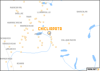
Chicliapata (Lima, Peru)Chicliapata is a town in the Lima region of Peru. An overview map of the region around Chicliapata is displayed below.
regional and 3d topo map of Chicliapata, Peru ::
Chicliapata airports ::
The nearest airport is LIM - Lima Jorge Chavez Intl, located 108.6 km west of Chicliapata.
Other airports nearby include PIO - Pisco Intl (197.6 km south), AYP - Ayacucho Coronel Fap Alfredo Mendivil Duarte (246.4 km south east), Nearby towns ::
Juripata (0.6km south east) //
Jupay (1.4km south) //
Puruchaja (2.3km south) //
Ucjo (2.8km south) //
Limactambo (3.7km south) //
Atunga (4.0km south west) //
Yanama (4.1km south west) //
Jullga (4.2km west) //
Huajracancha (4.7km south west) //
Totoral (4.8km south east) //
Huacaypaca (5.6km north west) //
Curco (6.2km north west) //
Tambo (6.3km south west) //
Carhuacayanga (6.7km north west) //
Huarmune (6.7km west) //
Collquepucro (7.6km south east) //
Llamapisillo (7.9km north) //
Laguna Puyhuancoto (8.1km north west) //
Pilcocancha (8.2km west) //
Ropacoto (8.4km north west) //
Tonto (8.5km north west) //
Panteón (8.7km north west) //
Pampacancha (8.7km west) //
Yauri (9.7km north west) //
[all distances 'as the bird flies' and approximate] 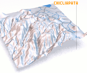 Places with similar names to Chicliapata, Peru :: Disclaimer :: Information on this page comes without warranty of any kind |
||
|
Where is Chicliapata? Elevation and coordinates ::
Latitude (lat): 11°57'41"S Longitude (lon): 76°7'7"W
Elevation (approx.): 4459m (map arrows pan, magnifying glasses zoom) |
||
|
Visiting Chicliapata? Hotel/Accommodation ::
Book a hotel in Chicliapata Travel Guide ::
Buy a travel guide for Peru rental cars ::
car rental offers GPS waypoint ::
download a GPX waypoint (PoI) of Chicliapata for your GPS receiver
|
||