|
search place name
|
||
Chingansa (Amazonas, Peru)Chingansa is a town in the Amazonas region of Peru. An overview map of the region around Chingansa is displayed below.
regional and 3d topo map of Chingansa, Peru ::

Chingansa airports ::
The nearest airport is CHH - Chachapoyas, located 113.8 km south east of Chingansa.
Other airports nearby include CIX - Chiclayo Capt Jose A Quinones Gonzales Intl (219.1 km south west), JJI - Juanjui (276.1 km south east), TBP - Tumbes Pedro Canga (293.2 km north west), Nearby towns ::
Susunsa (2.2km south) //
Tutumberos (2.9km north) //
Pomará (3.5km south) //
Tutumberos (4.6km north) //
Bellavista (5.1km south) //
Mirará (5.4km north) //
Aramango (6.1km south) //
El Muyo (6.5km south) //
Montenegro (7.4km north) //
Lumba (8.8km north east) //
Soldado Oliva (9.7km north east) //
[all distances 'as the bird flies' and approximate] 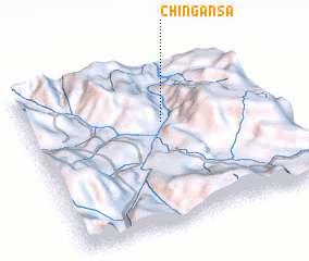 Places with similar names to Chingansa, Peru ::
// Shangunza I (CD)
// Chinkianas (EC)
// Changanesi (GH)
// Chinganze (ZM)
// Chinganaza (PE)
// Chingonza (MZ)
// Shenquansi (CN)
// Chaungnazu (MM)
// Tiona Kansi (CI)
Disclaimer :: Information on this page comes without warranty of any kind |
||
|
Where is Chingansa? Elevation and coordinates ::
Latitude (lat): 5°21'49"S Longitude (lon): 78°27'5"W
Elevation (approx.): 438m (map arrows pan, magnifying glasses zoom) |
||
|
Visiting Chingansa? Hotel/Accommodation ::
Book a hotel in Chingansa Travel Guide ::
Buy a travel guide for Peru rental cars ::
car rental offers GPS waypoint ::
download a GPX waypoint (PoI) of Chingansa for your GPS receiver
|
||