|
search place name
|
||
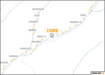
Chipe (Tacna, Peru)Chipe is a town in the Tacna region of Peru. An overview map of the region around Chipe is displayed below.
regional and 3d topo map of Chipe, Peru ::
Chipe airports ::
The nearest airport is TCQ - Tacna Coronel Carlos Ciriani Santa Rosa Intl, located 68.4 km south east of Chipe.
Other airports nearby include ARI - Arica Chacalluta (93.7 km south), AQP - Arequipa Rodriguez Ballon (166.7 km north west), Nearby towns ::
Los Troncos (2.1km north east) //
Sagollo (3.7km west) //
Margarata (3.8km north east) //
Huancarane (5.0km north east) //
Mal Paso (5.9km south west) //
Barrial (6.7km west) //
Cuaylata (6.8km south west) //
Oconchay (6.8km north east) //
Chirontita (7.4km north west) //
Chironta (7.8km north west) //
Cuaylatita (7.9km south west) //
Cinto (8.5km north west) //
Chaucalana (9.3km south west) //
Acongollo (9.2km north east) //
[all distances 'as the bird flies' and approximate]  Places with similar names to Chipe, Peru ::
Disclaimer :: Information on this page comes without warranty of any kind |
||
|
Where is Chipe? Elevation and coordinates ::
Latitude (lat): 17°33'42"S Longitude (lon): 70°39'58"W
Elevation (approx.): 789m (map arrows pan, magnifying glasses zoom) |
||
|
Visiting Chipe? Hotel/Accommodation ::
Book a hotel in Chipe Travel Guide ::
Buy a travel guide for Peru rental cars ::
car rental offers GPS waypoint ::
download a GPX waypoint (PoI) of Chipe for your GPS receiver
|
||