|
search place name
|
||
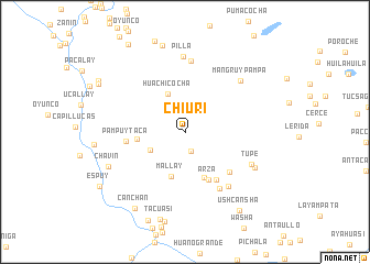
Chiuri (Lima, Peru)Chiuri is a town in the Lima region of Peru. An overview map of the region around Chiuri is displayed below.
regional and 3d topo map of Chiuri, Peru ::
Chiuri airports ::
The nearest airport is PIO - Pisco Intl, located 120.4 km south of Chiuri.
Other airports nearby include LIM - Lima Jorge Chavez Intl (155.3 km north west), AYP - Ayacucho Coronel Fap Alfredo Mendivil Duarte (187.3 km east), Nearby towns ::
Ajobamaba (2.0km south) //
Huanca Corral (3.9km south west) //
Huachicocha (4.2km north west) //
Mallay (4.7km south) //
Cachuy (4.8km west) //
Mushca (5.0km south east) //
Arza (5.4km south east) //
Mushjala (5.7km south east) //
Pampuytaca (5.9km west) //
Vichca (6.0km south east) //
Colca (6.7km south east) //
Cuya (7.0km south east) //
Llamionso (7.2km north) //
Tupe (7.4km south east) //
Mangruy Pampa (7.5km north east) //
Pilla (7.6km north) //
Huacoña (7.8km south east) //
Chavín (8.4km south west) //
Colonia (9.0km north) //
Tacuasi (9.2km south) //
Canchan (9.3km south west) //
Ushcansha (9.6km south east) //
San Lorenzo de Putinza (9.9km north west) //
Antarco (10.0km north west) //
Espuy (10.1km south west) //
[all distances 'as the bird flies' and approximate] 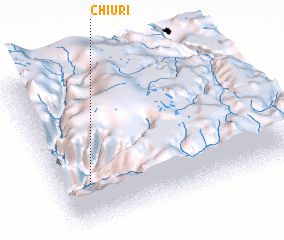 Places with similar names to Chiuri, Peru ::
Disclaimer :: Information on this page comes without warranty of any kind |
||
|
Where is Chiuri? Elevation and coordinates ::
Latitude (lat): 12°42'42"S Longitude (lon): 75°52'13"W
Elevation (approx.): 3417m (map arrows pan, magnifying glasses zoom) |
||
|
Visiting Chiuri? Hotel/Accommodation ::
Book a hotel in Chiuri Travel Guide ::
Buy a travel guide for Peru rental cars ::
car rental offers GPS waypoint ::
download a GPX waypoint (PoI) of Chiuri for your GPS receiver
|
||