|
search place name
|
||
Chucantito (Arequipa, Peru)Chucantito is a town in the Arequipa region of Peru. An overview map of the region around Chucantito is displayed below.
regional and 3d topo map of Chucantito, Peru ::

Chucantito airports ::
The nearest airport is AQP - Arequipa Rodriguez Ballon, located 197.0 km east of Chucantito.
Nearby towns ::
La Bodega (1.9km south west) //
Cascajo (1.9km south west) //
Ollería (1.9km south west) //
La Cantera (2.0km south) //
Cortaderas (2.0km south west) //
Hacienda Lacantera (2.0km south) //
Chirisco (2.1km south west) //
Viña del Señor (2.3km west) //
Hacienda Huachipa (2.3km south west) //
Ananta (2.5km south) //
Chucanito (2.9km south east) //
Chuicane (3.0km east) //
Hacienda Saitiña (3.1km south east) //
El Pasaje (3.2km south) //
Caldero (3.1km south west) //
Amargoso (3.3km west) //
Caspaya (3.7km south) //
Chincheros (3.8km south) //
Saitiño (3.8km south) //
Hacienda Ponce (3.9km south) //
Tres Cruces (4.1km north) //
Caravelí (4.1km west) //
Siquiquiña (4.3km west) //
Hacienda Huarca (4.6km south) //
Alto del Molino (4.9km west) //
Hacienda Huarca (5.3km south) //
Cajón del Horno (5.6km south) //
Gentilar (5.5km west) //
La Huarca (6.0km south) //
[all distances 'as the bird flies' and approximate] 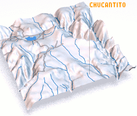 Places with similar names to Chucantito, Peru ::
// Chiquintad (EC)
// Chak One TDA (PK)
Disclaimer :: Information on this page comes without warranty of any kind |
||
|
Where is Chucantito? Elevation and coordinates ::
Latitude (lat): 15°46'3"S Longitude (lon): 73°19'35"W
Elevation (approx.): 1882m (map arrows pan, magnifying glasses zoom) |
||
|
Visiting Chucantito? Hotel/Accommodation ::
Book a hotel in Chucantito Travel Guide ::
Buy a travel guide for Peru rental cars ::
car rental offers GPS waypoint ::
download a GPX waypoint (PoI) of Chucantito for your GPS receiver
|
||