|
search place name
|
||
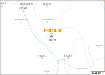
Churuja (Amazonas, Peru)Churuja is a town in the Amazonas region of Peru. An overview map of the region around Churuja is displayed below.
regional and 3d topo map of Churuja, Peru ::
Churuja airports ::
The nearest airport is CHH - Chachapoyas, located 21.5 km south of Churuja.
Other airports nearby include TPP - Tarapoto Cadete Guillermo Del Castillo Paredes (179.3 km east), JJI - Juanjui (183.0 km south east), YMS - Yurimaguas Moises Benzaquen Rengifo (199.6 km east), CIX - Chiclayo Capt Jose A Quinones Gonzales Intl (228.0 km west), Nearby towns ::
Valera (1.9km south) //
San Carlos (5.9km north) //
Paclas (8.3km south west) //
La Coca (9.2km south east) //
[all distances 'as the bird flies' and approximate] 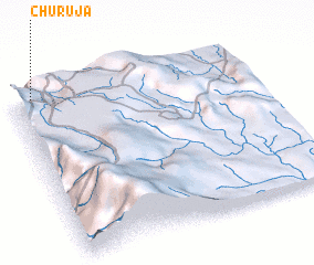 Places with similar names to Churuja, Peru ::
Disclaimer :: Information on this page comes without warranty of any kind |
||
|
Where is Churuja? Elevation and coordinates ::
Latitude (lat): 6°1'0"S Longitude (lon): 77°55'0"W
Elevation (approx.): 2637m (map arrows pan, magnifying glasses zoom) |
||
|
Visiting Churuja? Hotel/Accommodation ::
Book a hotel in Churuja Travel Guide ::
Buy a travel guide for Peru rental cars ::
car rental offers GPS waypoint ::
download a GPX waypoint (PoI) of Churuja for your GPS receiver
|
||