|
search place name
|
||
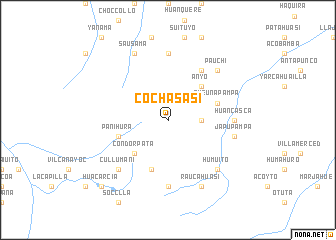
Cochasasi (Apurímac, Peru)Cochasasi is a town in the Apurímac region of Peru. An overview map of the region around Cochasasi is displayed below.
regional and 3d topo map of Cochasasi, Peru ::
Cochasasi airports ::
The nearest airport is CUZ - Cuzco Teniente Alejandro Velasco Astete Intl, located 95.6 km north east of Cochasasi.
Other airports nearby include ANS - Andahuaylas (130.5 km north west), AYP - Ayacucho Coronel Fap Alfredo Mendivil Duarte (241.3 km north west), Nearby towns ::
Fierropunco (3.6km east) //
Challuapujo (3.6km east) //
Condorpata (5.2km south west) //
Anyo (5.2km north east) //
Panihura (5.7km west) //
Cento-cocha (5.8km south) //
Queuñapampa (5.7km east) //
Oscollo (6.6km north east) //
Coñagmarca (7.4km south) //
Huancasca (7.2km east) //
Racramachay (7.4km north) //
Japupampa (7.4km east) //
Cullumani (7.7km south west) //
Humuito (7.7km south east) //
Pauchi (7.7km north east) //
Raucahuasi (8.2km south east) //
Sausama (8.2km north west) //
Huacarcia (10.3km south west) //
[all distances 'as the bird flies' and approximate] 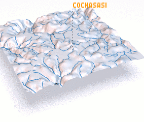 Places with similar names to Cochasasi, Peru ::
// Kochcice (PL)
Disclaimer :: Information on this page comes without warranty of any kind |
||
|
Where is Cochasasi? Elevation and coordinates ::
Latitude (lat): 14°19'0"S Longitude (lon): 72°19'0"W
Elevation (approx.): 4523m (map arrows pan, magnifying glasses zoom) |
||
|
Visiting Cochasasi? Hotel/Accommodation ::
Book a hotel in Cochasasi Travel Guide ::
Buy a travel guide for Peru rental cars ::
car rental offers GPS waypoint ::
download a GPX waypoint (PoI) of Cochasasi for your GPS receiver
|
||