|
search place name
|
||
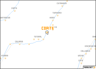
Copite (Lima, Peru)Copite is a town in the Lima region of Peru. An overview map of the region around Copite is displayed below.
regional and 3d topo map of Copite, Peru ::
Copite airports ::
The nearest airport is LIM - Lima Jorge Chavez Intl, located 89.6 km north west of Copite.
Other airports nearby include PIO - Pisco Intl (140.0 km south), Nearby towns ::
Huancané (2.6km north east) //
Cochahuasi (2.6km south west) //
Totoral (4.1km south west) //
Corral Quemado (4.1km north east) //
La Capilla (5.7km west) //
Minay (5.8km north) //
Yuncaviri (8.1km south west) //
Turihuasi (8.2km north east) //
[all distances 'as the bird flies' and approximate] 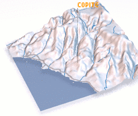 Places with similar names to Copite, Peru ::
Disclaimer :: Information on this page comes without warranty of any kind |
||
|
Where is Copite? Elevation and coordinates ::
Latitude (lat): 12°30'0"S Longitude (lon): 76°27'0"W
Elevation (approx.): 974m (map arrows pan, magnifying glasses zoom) |
||
|
Visiting Copite? Hotel/Accommodation ::
Book a hotel in Copite Travel Guide ::
Buy a travel guide for Peru rental cars ::
car rental offers GPS waypoint ::
download a GPX waypoint (PoI) of Copite for your GPS receiver
|
||