|
search place name
|
||
El Cardo (Lambayeque, Peru)El Cardo is a town in the Lambayeque region of Peru. An overview map of the region around El Cardo is displayed below.
regional and 3d topo map of El Cardo, Peru ::

El Cardo airports ::
The nearest airport is CIX - Chiclayo Capt Jose A Quinones Gonzales Intl, located 102.5 km south of El Cardo.
Other airports nearby include PIU - Piura Capitan Fap Guillermo Concha Iberico (109.4 km north west), TYL - Talara Capitan Montes (208.5 km north west), Nearby towns ::
Laguna Larga (1.9km east) //
El Puente (2.4km south) //
Noria de Mallanza (3.3km north east) //
La Calera (3.5km north) //
Oberasal (4.5km west) //
La Cruz del Puente (5.0km south) //
Corral de Arena (6.5km south east) //
San Cristóbal (6.7km west) //
La Vega Barril (6.7km east) //
Pasabar (6.9km east) //
Laucha (7.4km south west) //
Tico Tico (7.8km east) //
Hualtacal (8.1km north) //
La Estancia (8.5km east) //
San Juan (8.6km south east) //
Mocape (8.7km north east) //
La Esperanza (8.7km south east) //
Llausaque (9.0km south east) //
Los Callejones de Cascajal (10.5km south east) //
Nichipo (10.7km south east) //
[all distances 'as the bird flies' and approximate] 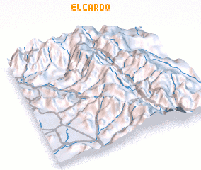 Places with similar names to El Cardo, Peru ::
// El Kourat (MA)
// El Krada (MA)
// El Kriet (MA)
// El Krit (MA)
// El Carate (PA)
// El Corotú (PA)
// El Corotú (PA)
// El Garrote (PA)
// El Lagarto (PA)
// El Corte (CU)
Disclaimer :: Information on this page comes without warranty of any kind |
||
|
Where is El Cardo? Elevation and coordinates ::
Latitude (lat): 5°51'43"S Longitude (lon): 79°52'39"W
Elevation (approx.): 111m (map arrows pan, magnifying glasses zoom) |
||
|
Visiting El Cardo? Hotel/Accommodation ::
Book a hotel in El Cardo Travel Guide ::
Buy a travel guide for Peru rental cars ::
car rental offers GPS waypoint ::
download a GPX waypoint (PoI) of El Cardo for your GPS receiver
|
||