|
search place name
|
||
Erhuaca (Lima, Peru)Erhuaca is a town in the Lima region of Peru. An overview map of the region around Erhuaca is displayed below.
regional and 3d topo map of Erhuaca, Peru ::

Erhuaca airports ::
The nearest airport is PIO - Pisco Intl, located 122.3 km south of Erhuaca.
Other airports nearby include LIM - Lima Jorge Chavez Intl (144.8 km north west), AYP - Ayacucho Coronel Fap Alfredo Mendivil Duarte (197.7 km east), Nearby towns ::
San Lorenzo de Putinza (0.9km east) //
Antarco (1.1km north east) //
Pacalay (1.7km north west) //
Ucallay (2.1km south west) //
Concubay (2.9km north west) //
Capillucas (4.4km south) //
Calachota (5.0km north west) //
Antamala (5.0km north west) //
Oyunco (5.0km south west) //
Zañin (5.6km north) //
Cacsana (5.7km north east) //
Pisacha (5.8km north east) //
Chicchicay (6.0km south) //
Quirman (6.3km north west) //
Pampaca (6.5km north east) //
Pompucro (6.5km north) //
Vichca (6.6km north) //
Pampuytaca (6.7km south east) //
Oyunco (6.7km north east) //
Cotocha (6.9km north east) //
Huayra Pucro (7.1km north) //
Quirman (7.1km south) //
Quische (7.2km north) //
Cachuy (7.2km south east) //
Sibia (7.4km north west) //
Huachicocha (7.8km east) //
San Marcelo (8.0km north) //
Estanque (8.0km north) //
Mulacanisho (7.9km north east) //
[all distances 'as the bird flies' and approximate] 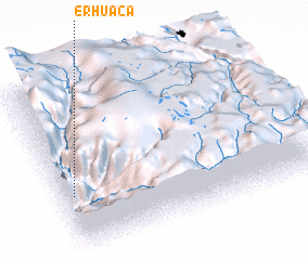 Places with similar names to Erhuaca, Peru ::
// Erhekou (CN)
Disclaimer :: Information on this page comes without warranty of any kind |
||
|
Where is Erhuaca? Elevation and coordinates ::
Latitude (lat): 12°40'11"S Longitude (lon): 75°57'27"W
Elevation (approx.): 1652m (map arrows pan, magnifying glasses zoom) |
||
|
Visiting Erhuaca? Hotel/Accommodation ::
Book a hotel in Erhuaca Travel Guide ::
Buy a travel guide for Peru rental cars ::
car rental offers GPS waypoint ::
download a GPX waypoint (PoI) of Erhuaca for your GPS receiver
|
||