|
search place name
|
||
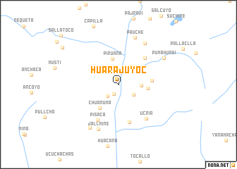
Huarajuyoc (Arequipa, Peru)Huarajuyoc is a town in the Arequipa region of Peru. An overview map of the region around Huarajuyoc is displayed below.
regional and 3d topo map of Huarajuyoc, Peru ::
Huarajuyoc airports ::
The nearest airport is AQP - Arequipa Rodriguez Ballon, located 110.3 km south east of Huarajuyoc.
Other airports nearby include JUL - Juliaca (198.0 km east), CUZ - Cuzco Teniente Alejandro Velasco Astete Intl (209.8 km north), ANS - Andahuaylas (239.8 km north west), Nearby towns ::
Jatuncondire (1.6km south west) //
Pachahuma (2.5km south west) //
Hacienda Japo (2.8km south east) //
Hacienda Limapampa (3.4km north east) //
Chapioc (3.5km east) //
Piruaña (4.2km north) //
Huacchane (4.1km north east) //
Uraychaña (4.5km east) //
Chuañuma (4.7km south west) //
Hacienda Kenco (5.1km east) //
Huaccoto (5.8km north east) //
Toccallo (6.2km south) //
Pisaca (6.5km south west) //
Ucria (6.9km south east) //
Chusña (7.7km north east) //
Jallmine (7.7km south west) //
Pauche (7.8km north) //
Humajala (8.2km south west) //
Pumahuasi (8.2km north east) //
[all distances 'as the bird flies' and approximate] 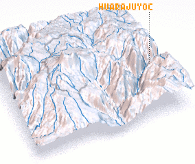 Places with similar names to Huarajuyoc, Peru :: Disclaimer :: Information on this page comes without warranty of any kind |
||
|
Where is Huarajuyoc? Elevation and coordinates ::
Latitude (lat): 15°25'52"S Longitude (lon): 72°0'11"W
Elevation (approx.): 4299m (map arrows pan, magnifying glasses zoom) |
||
|
Visiting Huarajuyoc? Hotel/Accommodation ::
Book a hotel in Huarajuyoc Travel Guide ::
Buy a travel guide for Peru rental cars ::
car rental offers GPS waypoint ::
download a GPX waypoint (PoI) of Huarajuyoc for your GPS receiver
|
||