|
search place name
|
||
Huarangal (Ica, Peru)Huarangal is a town in the Ica region of Peru. An overview map of the region around Huarangal is displayed below.
regional and 3d topo map of Huarangal, Peru ::

Huarangal airports ::
The nearest airport is PIO - Pisco Intl, located 38.3 km west of Huarangal.
Other airports nearby include AYP - Ayacucho Coronel Fap Alfredo Mendivil Duarte (191.0 km east), LIM - Lima Jorge Chavez Intl (232.8 km north west), Nearby towns ::
Monte Sierpe (1.9km north) //
Pallasca (2.6km north east) //
La Capacha (3.6km west) //
Humay (4.0km north west) //
Miraflores (4.0km north east) //
Pantaico (4.0km north east) //
San Ignacio (5.4km west) //
Auquish (6.6km north east) //
Cruz de Callana (7.4km west) //
Rancho Chico (7.4km west) //
Chanchamayo (8.1km north east) //
Hualla Grande (9.1km north east) //
Hualla Chico (9.1km north east) //
[all distances 'as the bird flies' and approximate] 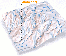 Places with similar names to Huarangal, Peru ::
// Hayrangöl (TR)
// Harangul (IN)
// Haranggaul (ID)
// Horno Cal (MX)
// Harangala (LK)
// Harannagala (LK)
// Horangala (LK)
// Horangalla (LK)
// Herānkeleh (IR)
// Huarangal (PE)
Disclaimer :: Information on this page comes without warranty of any kind |
||
|
Where is Huarangal? Elevation and coordinates ::
Latitude (lat): 13°44'0"S Longitude (lon): 75°52'0"W
Elevation (approx.): 477m (map arrows pan, magnifying glasses zoom) |
||
|
Visiting Huarangal? Hotel/Accommodation ::
Book a hotel in Huarangal Travel Guide ::
Buy a travel guide for Peru rental cars ::
car rental offers GPS waypoint ::
download a GPX waypoint (PoI) of Huarangal for your GPS receiver
|
||