|
search place name
|
||
Japrapampa (Lima, Peru)Japrapampa is a town in the Lima region of Peru. An overview map of the region around Japrapampa is displayed below.
regional and 3d topo map of Japrapampa, Peru ::

Japrapampa airports ::
The nearest airport is LIM - Lima Jorge Chavez Intl, located 128.1 km south of Japrapampa.
Other airports nearby include ATA - Anta Comandante Fap German Arias Graziani (201.7 km north west), CHM - Chimbote Teniente Jaime A De Montreuil Morales (281.3 km north west), Nearby towns ::
Chirismachay (0.9km north west) //
Yachapaco (0.9km west) //
Minapata (0.9km north west) //
Putupcagana (1.1km north west) //
San Pedro (1.5km south east) //
Pascuain (1.5km south east) //
Huiscarangra (1.5km west) //
Japur (1.7km south) //
Lamahuanonga (1.8km south east) //
Atoshuain (1.8km south east) //
Yuracchala (1.9km south) //
Pupuchinchan (1.9km north) //
Riguan (2.0km south) //
Gallupato (2.1km west) //
Piscay (2.1km south east) //
Chuncacocha (2.4km north) //
Jutjo (2.6km north) //
Temblorpuquio (2.7km west) //
Liau Liau (2.8km east) //
Pitago (2.9km north west) //
Ginara (3.2km north) //
Chuchún (3.3km north west) //
Tranca (3.4km south) //
Quistupacancha (3.6km south east) //
Parquín (3.6km south west) //
Pallcachico (3.8km south east) //
Huacucho (3.9km north west) //
Huanchac (4.3km north) //
Pallca Grande (4.4km south east) //
[all distances 'as the bird flies' and approximate] 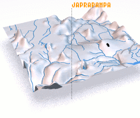 Places with similar names to Japrapampa, Peru :: Disclaimer :: Information on this page comes without warranty of any kind |
||
|
Where is Japrapampa? Elevation and coordinates ::
Latitude (lat): 10°56'19"S Longitude (lon): 76°41'59"W
Elevation (approx.): 4396m (map arrows pan, magnifying glasses zoom) |
||
|
Visiting Japrapampa? Hotel/Accommodation ::
Book a hotel in Japrapampa Travel Guide ::
Buy a travel guide for Peru rental cars ::
car rental offers GPS waypoint ::
download a GPX waypoint (PoI) of Japrapampa for your GPS receiver
|
||