|
search place name
|
||
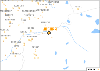
Joshpa (Lima, Peru)Joshpa is a town in the Lima region of Peru. An overview map of the region around Joshpa is displayed below.
regional and 3d topo map of Joshpa, Peru ::
Joshpa airports ::
The nearest airport is LIM - Lima Jorge Chavez Intl, located 93.3 km south west of Joshpa.
Nearby towns ::
Jashtachin (0.9km south east) //
Cullhuay (2.8km north west) //
Chauco (3.2km west) //
Osacocha (4.5km north west) //
Bunabamba (6.8km west) //
Marco Pucro (7.1km west) //
Chanicancha (7.3km west) //
Huaros (7.4km west) //
Gasgas (7.5km south west) //
Mincacancha (7.6km north) //
Huacshahuanca (7.8km north west) //
Tulpayo (8.0km south west) //
Torocancha (7.9km west) //
Churcuna (8.3km north west) //
Huaypian (8.7km north west) //
Lanera (9.0km south west) //
Jaspacancha (9.2km north) //
Condorhuachanan (9.2km south west) //
Shuytogo (9.6km south west) //
Huagurupata (9.8km north west) //
Chacramito (10.2km south west) //
Yamecoto (10.3km north west) //
Pilcocanchan (11.5km north west) //
[all distances 'as the bird flies' and approximate] 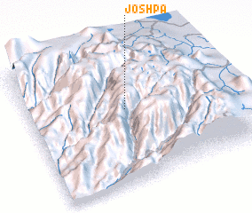 Places with similar names to Joshpa, Peru ::
Disclaimer :: Information on this page comes without warranty of any kind |
||
|
Where is Joshpa? Elevation and coordinates ::
Latitude (lat): 11°25'23"S Longitude (lon): 76°30'42"W
Elevation (approx.): 4122m (map arrows pan, magnifying glasses zoom) |
||
|
Visiting Joshpa? Hotel/Accommodation ::
Book a hotel in Joshpa Travel Guide ::
Buy a travel guide for Peru rental cars ::
car rental offers GPS waypoint ::
download a GPX waypoint (PoI) of Joshpa for your GPS receiver
|
||