|
search place name
|
||
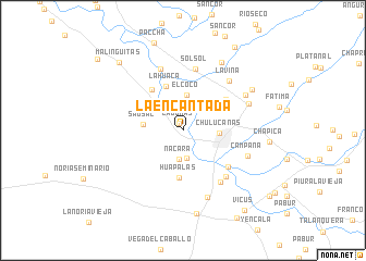
La Encantada (Piura, Peru)La Encantada is a town in the Piura region of Peru. An overview map of the region around La Encantada is displayed below.
regional and 3d topo map of La Encantada, Peru ::
La Encantada airports ::
The nearest airport is PIU - Piura Capitan Fap Guillermo Concha Iberico, located 48.3 km west of La Encantada.
Other airports nearby include TYL - Talara Capitan Montes (130.4 km north west), TBP - Tumbes Pedro Canga (171.2 km north), CIX - Chiclayo Capt Jose A Quinones Gonzales Intl (192.1 km south), MCH - Machala General Manuel Serrano (203.0 km north), Nearby towns ::
Lagunas (0.8km north west) //
Huápalas (2.9km south) //
Nácara (3.0km south) //
El Coco (3.7km north) //
Chulucanas (3.7km east) //
Sausal (4.1km west) //
Huápalas (4.9km south) //
La Huaca (4.9km north) //
Hacienda Nomala (5.3km north west) //
Nomala (5.3km north west) //
Santa Maria (5.4km north east) //
San Martín (6.0km south east) //
Solsol (6.4km north) //
Santa Leticia (6.4km south east) //
Huasimal (6.6km south east) //
La Soledad (6.7km north) //
La Viña (6.9km north east) //
Campana (7.1km east) //
El Dos (7.3km south) //
Hacienda Yapatera (7.3km east) //
Yapatera (7.4km north east) //
Belen (8.0km north east) //
Cruz Pampa (8.2km north east) //
El Cincuenta (8.7km south) //
Chapica (8.9km east) //
Malinguitas (9.5km north west) //
Solsol (10.1km north east) //
Vicus (10.3km south east) //
Potrerillo (11.1km south east) //
[all distances 'as the bird flies' and approximate]  Places with similar names to La Encantada, Peru ::
// La Encantada (PA)
// La Encantada (MX)
// La Encantada (MX)
// La Encantada (MX)
// La Encantada (MX)
// La Encantada (MX)
// La Encantada (MX)
// La Encantada (MX)
// La Encantada (MX)
// La Encantada (VE)
Disclaimer :: Information on this page comes without warranty of any kind |
||
|
Where is La Encantada? Elevation and coordinates ::
Latitude (lat): 5°5'23"S Longitude (lon): 80°11'46"W
Elevation (approx.): 84m (map arrows pan, magnifying glasses zoom) |
||
|
Visiting La Encantada? Hotel/Accommodation ::
Book a hotel in La Encantada Travel Guide ::
Buy a travel guide for Peru rental cars ::
car rental offers GPS waypoint ::
download a GPX waypoint (PoI) of La Encantada for your GPS receiver
|
||