|
search place name
|
||
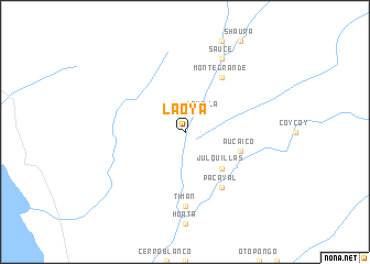
La Oya (Lima, Peru)La Oya is a town in the Lima region of Peru. An overview map of the region around La Oya is displayed below.
regional and 3d topo map of La Oya, Peru ::
La Oya airports ::
The nearest airport is ATA - Anta Comandante Fap German Arias Graziani, located 128.8 km north of La Oya.
Other airports nearby include CHM - Chimbote Teniente Jaime A De Montreuil Morales (170.9 km north west), LIM - Lima Jorge Chavez Intl (182.8 km south east), Nearby towns ::
Huaricanga (1.9km north) //
La Villa (2.6km north east) //
Cutatambo (2.6km north east) //
Julquillas (5.2km south east) //
Aucaico (5.8km east) //
Monte Grande (6.6km north east) //
Pacayal (6.6km south east) //
Timan (7.4km south) //
Sauce (8.3km north east) //
[all distances 'as the bird flies' and approximate] 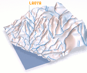 Places with similar names to La Oya, Peru ::
Disclaimer :: Information on this page comes without warranty of any kind |
||
|
Where is La Oya? Elevation and coordinates ::
Latitude (lat): 10°30'0"S Longitude (lon): 77°46'0"W
Elevation (approx.): 300m (map arrows pan, magnifying glasses zoom) |
||
|
Visiting La Oya? Hotel/Accommodation ::
Book a hotel in La Oya Travel Guide ::
Buy a travel guide for Peru rental cars ::
car rental offers GPS waypoint ::
download a GPX waypoint (PoI) of La Oya for your GPS receiver
|
||