|
search place name
|
||
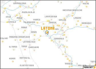
La Toma (Piura, Peru)La Toma is a town in the Piura region of Peru. An overview map of the region around La Toma is displayed below.
regional and 3d topo map of La Toma, Peru ::
La Toma airports ::
The nearest airport is PIU - Piura Capitan Fap Guillermo Concha Iberico, located 68.1 km west of La Toma.
Other airports nearby include TYL - Talara Capitan Montes (155.8 km north west), CIX - Chiclayo Capt Jose A Quinones Gonzales Intl (175.0 km south), TBP - Tumbes Pedro Canga (188.6 km north), MCH - Machala General Manuel Serrano (215.2 km north), Nearby towns ::
Chihuahua (1.5km south east) //
Huaquilla (1.6km north west) //
Piedra Blanca (2.3km north west) //
Pueblo Nuevo (2.7km south east) //
Polvasal (2.9km east) //
Hacienda Pabur (3.0km west) //
Pedregal (3.4km south east) //
Carrasquillo (4.0km south west) //
Zapotal (4.1km north east) //
Franco Viejo (4.5km north west) //
Morropón (5.1km north east) //
Tamarindo (5.1km south east) //
Piedra Blanca (5.3km north) //
Piedra Blanca (5.3km north) //
Rosos (5.3km west) //
Mejico Chico (5.5km north east) //
Pampa de la Hacienda (5.6km east) //
Laynas (5.7km west) //
Ingenio (5.8km east) //
La Rinconada (5.9km north) //
Corral del Medio (6.0km east) //
El Alba (6.1km north east) //
Franco (6.2km north west) //
La Pirca (6.3km east) //
Santa Elena (6.4km south east) //
Hacienda Buenos Aires (6.4km east) //
Buenos Aires (6.6km south east) //
Cerritos (7.0km south east) //
La Maravilla (7.1km east) //
[all distances 'as the bird flies' and approximate] 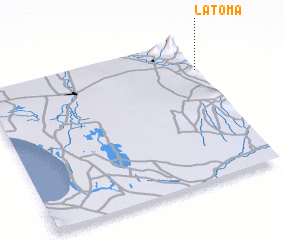 Places with similar names to La Toma, Peru ::
Disclaimer :: Information on this page comes without warranty of any kind |
||
|
Where is La Toma? Elevation and coordinates ::
Latitude (lat): 5°12'53"S Longitude (lon): 80°0'7"W
Elevation (approx.): 113m (map arrows pan, magnifying glasses zoom) |
||
|
Visiting La Toma? Hotel/Accommodation ::
Book a hotel in La Toma Travel Guide ::
Buy a travel guide for Peru rental cars ::
car rental offers GPS waypoint ::
download a GPX waypoint (PoI) of La Toma for your GPS receiver
|
||