|
search place name
|
||
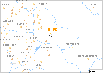
Laura (Arequipa, Peru)Laura is a town in the Arequipa region of Peru. An overview map of the region around Laura is displayed below.
regional and 3d topo map of Laura, Peru ::
Laura airports ::
The nearest airport is AQP - Arequipa Rodriguez Ballon, located 90.3 km south west of Laura.
Other airports nearby include JUL - Juliaca (95.9 km east), Nearby towns ::
Calacala (2.3km north) //
Ancolacaya (2.6km south west) //
Ccallaccalla (2.8km north west) //
Puticaico (3.7km south west) //
Purunta (4.7km north west) //
Huarayane (5.3km north west) //
Huañutaña (5.4km south) //
Jaurillane (5.3km north west) //
Huincaya (6.2km west) //
Apacheta (6.6km north west) //
Trigutaña (6.5km west) //
Pucrotaña (6.8km south) //
Huilasaya (7.2km west) //
Huiscachani (7.4km north west) //
Peña Blanca (8.2km north west) //
Anduyu (8.3km west) //
Capichaca (8.5km north west) //
La Capilla (8.7km north west) //
Crucero Alto (8.6km south east) //
Namuta (8.7km south west) //
Collca (8.8km west) //
Hacienda Colca (9.3km north west) //
Huancayane (10.5km south west) //
Chocopata (10.6km south west) //
Tahuacollo (11.1km north west) //
Capichaca (11.2km north west) //
[all distances 'as the bird flies' and approximate] 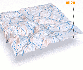 Places with similar names to Laura, Peru ::
Disclaimer :: Information on this page comes without warranty of any kind |
||
|
Where is Laura? Elevation and coordinates ::
Latitude (lat): 15°44'51"S Longitude (lon): 71°0'15"W
Elevation (approx.): 4524m (map arrows pan, magnifying glasses zoom) |
||
|
Visiting Laura? Hotel/Accommodation ::
Book a hotel in Laura Travel Guide ::
Buy a travel guide for Peru rental cars ::
car rental offers GPS waypoint ::
download a GPX waypoint (PoI) of Laura for your GPS receiver
|
||