|
search place name
|
||
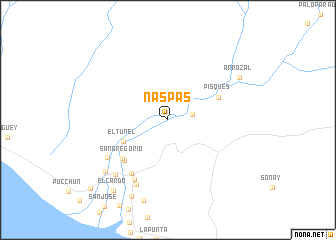
Naspas (Arequipa, Peru)Naspas is a town in the Arequipa region of Peru. An overview map of the region around Naspas is displayed below.
regional and 3d topo map of Naspas, Peru ::
Naspas airports ::
The nearest airport is AQP - Arequipa Rodriguez Ballon, located 118.2 km east of Naspas.
Nearby towns ::
Characta (2.6km east) //
El Túnel (5.3km south west) //
Pisques (6.0km north east) //
San Gregorio (6.5km south west) //
San Gregorio (6.5km south west) //
El Medio Hacienda (7.2km south west) //
San Jacinto (7.5km south west) //
Los Pacaecitos (7.6km south west) //
Huarangal (8.0km south west) //
La Salada (8.3km south west) //
El Puente (8.8km south west) //
Arrozal (9.0km north east) //
El Monte (9.4km south west) //
El Cardo (9.8km south west) //
Huacapuy (11.3km south west) //
[all distances 'as the bird flies' and approximate] 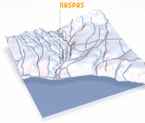 Places with similar names to Naspas, Peru ::
Disclaimer :: Information on this page comes without warranty of any kind |
||
|
Where is Naspas? Elevation and coordinates ::
Latitude (lat): 16°31'57"S Longitude (lon): 72°40'18"W
Elevation (approx.): 213m (map arrows pan, magnifying glasses zoom) |
||
|
Visiting Naspas? Hotel/Accommodation ::
Book a hotel in Naspas Travel Guide ::
Buy a travel guide for Peru rental cars ::
car rental offers GPS waypoint ::
download a GPX waypoint (PoI) of Naspas for your GPS receiver
|
||