|
search place name
|
||
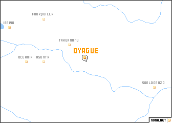
Oyague (Madre de Dios, Peru)Oyague is a town in the Madre de Dios region of Peru. An overview map of the region around Oyague is displayed below.
regional and 3d topo map of Oyague, Peru ::
Oyague airports ::
The nearest airport is CIJ - Cobija Heroes Del Acre, located 82.3 km north east of Oyague.
Other airports nearby include PEM - Puerto Maldonado Padre Aldamiz (134.3 km south), RBR - Rio Branco Presidente Medici (240.1 km north east), Nearby towns ::
Tahuamanú (5.2km north west) //
[all distances 'as the bird flies' and approximate] 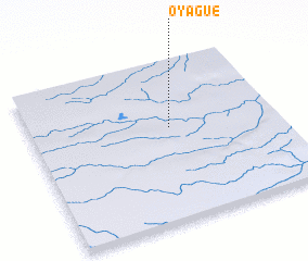 Places with similar names to Oyague, Peru ::
Disclaimer :: Information on this page comes without warranty of any kind |
||
|
Where is Oyague? Elevation and coordinates ::
Latitude (lat): 11°25'0"S Longitude (lon): 69°26'0"W
Elevation (approx.): 297m (map arrows pan, magnifying glasses zoom) |
||
|
Visiting Oyague? Hotel/Accommodation ::
Book a hotel in Oyague Travel Guide ::
Buy a travel guide for Peru rental cars ::
car rental offers GPS waypoint ::
download a GPX waypoint (PoI) of Oyague for your GPS receiver
|
||