|
search place name
|
||
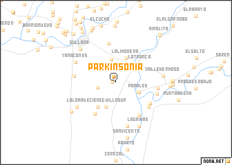
Parkinsonia (Piura, Peru)Parkinsonia is a town in the Piura region of Peru. An overview map of the region around Parkinsonia is displayed below.
regional and 3d topo map of Parkinsonia, Peru ::
Parkinsonia airports ::
The nearest airport is PIU - Piura Capitan Fap Guillermo Concha Iberico, located 28.1 km south of Parkinsonia.
Other airports nearby include TYL - Talara Capitan Montes (80.4 km north west), TBP - Tumbes Pedro Canga (157.3 km north), MCH - Machala General Manuel Serrano (200.6 km north), CIX - Chiclayo Capt Jose A Quinones Gonzales Intl (221.6 km south east), Nearby towns ::
Cieneguillo Central (0.6km west) //
Dos Compuertas (3.1km west) //
San Juan de los Ranchos (3.8km north) //
Olivares de San Fernando (4.0km south east) //
Parales (4.0km south east) //
Villa Maria (4.1km north west) //
Cieneguilla Sur Lateral A (4.2km south) //
La Limonera (4.3km north) //
La Loma de Cieneguillo Sur (5.0km south west) //
La Tranca (5.0km north east) //
Santa Rosa de Cieneguillo Sur (6.1km south west) //
Las Mercedes de Cieneguilla Norte (6.4km north) //
Parales (6.4km south east) //
La Obrilla (6.5km south east) //
San Rafael (6.6km south east) //
El Bendito (6.8km west) //
La Quebrada (6.8km east) //
La Loma (6.8km east) //
Yanacones (7.3km north west) //
Curumuy (7.4km south) //
Canal Mocho (7.4km south west) //
Valle Hermoso (7.7km east) //
Sullana (7.9km north west) //
Lágrimas (8.0km south east) //
Nuevo Progreso de Canal Mocho (8.6km south west) //
San Baltazar (8.8km east) //
Santa Sofia (9.3km north west) //
Transbal (9.6km north west) //
Oriente (9.8km north west) //
[all distances 'as the bird flies' and approximate] 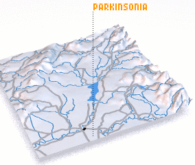 Places with similar names to Parkinsonia, Peru ::
// Parkinson (US)
Disclaimer :: Information on this page comes without warranty of any kind |
||
|
Where is Parkinsonia? Elevation and coordinates ::
Latitude (lat): 4°57'9"S Longitude (lon): 80°38'0"W
Elevation (approx.): 92m (map arrows pan, magnifying glasses zoom) |
||
|
Visiting Parkinsonia? Hotel/Accommodation ::
Book a hotel in Parkinsonia Travel Guide ::
Buy a travel guide for Peru rental cars ::
car rental offers GPS waypoint ::
download a GPX waypoint (PoI) of Parkinsonia for your GPS receiver
|
||