|
search place name
|
||
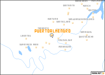
Puerto Almendro (Loreto, Peru)Puerto Almendro is a town in the Loreto region of Peru. An overview map of the region around Puerto Almendro is displayed below.
regional and 3d topo map of Puerto Almendro, Peru ::
Puerto Almendro airports ::
The nearest airport is IQT - Iquitos Coronel Francisco Secada Vignetta Intl, located 8.7 km north east of Puerto Almendro.
Nearby towns ::
Zungaro Cocha (2.0km east) //
Ninarumi (2.4km south west) //
Esperanza (2.9km south west) //
Tarapoto (4.0km north west) //
Santa Tomás (4.2km north east) //
Llanchama (5.0km south west) //
Cruz del Sur (5.0km south east) //
Huaturia (5.7km north) //
Santa Clara (6.1km north east) //
Peñanegra (6.2km south east) //
Paña (6.8km south west) //
Rumoc Cocha (8.8km north east) //
San Pedro (10.0km north east) //
San José de Lupuna (10.5km north east) //
[all distances 'as the bird flies' and approximate] 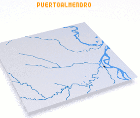 Places with similar names to Puerto Almendro, Peru :: Disclaimer :: Information on this page comes without warranty of any kind |
||
|
Where is Puerto Almendro? Elevation and coordinates ::
Latitude (lat): 3°49'34"S Longitude (lon): 73°22'33"W
Elevation (approx.): 96m (map arrows pan, magnifying glasses zoom) |
||
|
Visiting Puerto Almendro? Hotel/Accommodation ::
Book a hotel in Puerto Almendro Travel Guide ::
Buy a travel guide for Peru rental cars ::
car rental offers GPS waypoint ::
download a GPX waypoint (PoI) of Puerto Almendro for your GPS receiver
|
||