|
search place name
|
||
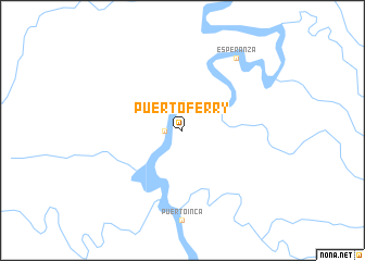
Puerto Ferry (Huánuco, Peru)Puerto Ferry is a town in the Huánuco region of Peru. An overview map of the region around Puerto Ferry is displayed below.
regional and 3d topo map of Puerto Ferry, Peru ::
Puerto Ferry airports ::
The nearest airport is PCL - Pucallpa Cap Fap David Abenzur Rengifo Intl, located 109.0 km north east of Puerto Ferry.
Nearby towns ::
San Antonio (1.8km west) //
Esperanza (9.2km north east) //
[all distances 'as the bird flies' and approximate]  Places with similar names to Puerto Ferry, Peru ::
// Pôrto Faria (BR)
// Pôrto Ferrão (BR)
// Puerto Frío (PA)
// Poira di Fuori (IT)
// Porto Fuori (IT)
// Pradovera (IT)
// Praia da Vieira (PT)
// Port Ivory (US)
// Portoferraio (IT)
// Preddvor (SI)
Disclaimer :: Information on this page comes without warranty of any kind |
||
|
Where is Puerto Ferry? Elevation and coordinates ::
Latitude (lat): 9°17'0"S Longitude (lon): 74°58'0"W
Elevation (approx.): 205m (map arrows pan, magnifying glasses zoom) |
||
|
Visiting Puerto Ferry? Hotel/Accommodation ::
Book a hotel in Puerto Ferry Travel Guide ::
Buy a travel guide for Peru rental cars ::
car rental offers GPS waypoint ::
download a GPX waypoint (PoI) of Puerto Ferry for your GPS receiver
|
||