|
search place name
|
||
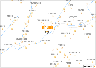
Raure (Lima, Peru)Raure is a town in the Lima region of Peru. An overview map of the region around Raure is displayed below.
regional and 3d topo map of Raure, Peru ::
Raure airports ::
The nearest airport is LIM - Lima Jorge Chavez Intl, located 84.6 km south of Raure.
Other airports nearby include ATA - Anta Comandante Fap German Arias Graziani (230.8 km north), Nearby towns ::
Chula (1.6km north west) //
Chalamaque (2.9km north east) //
Puente Mataca (3.1km north east) //
Callantama (3.8km north west) //
Colcapampa (3.8km south) //
Rumo (3.9km north) //
Mancay (4.4km north) //
Sogospuquio (4.5km north west) //
Maraccaico (4.8km north) //
Acos (4.9km north east) //
Collan Chico (5.1km north west) //
Huayo Ingenio (6.0km south west) //
Pirca Huasi (6.2km north east) //
Cucapunco (6.5km south) //
La Florida (6.7km east) //
San Agustin de Huayopampa (6.9km south east) //
Canchapilca (7.1km north east) //
Lampian (7.2km north) //
Pallac (7.6km south east) //
Canchapilca (8.1km north east) //
Vilca Alta (8.3km south west) //
Canchar (8.4km north east) //
Huayo (8.4km south west) //
Yunguy (8.4km west) //
Piscocoto (8.5km south east) //
Huaracnic (8.5km west) //
Pampas (8.8km east) //
Lanco (9.0km west) //
Quinquera (9.0km north west) //
[all distances 'as the bird flies' and approximate]  Places with similar names to Raure, Peru ::
Disclaimer :: Information on this page comes without warranty of any kind |
||
|
Where is Raure? Elevation and coordinates ::
Latitude (lat): 11°18'2"S Longitude (lon): 76°51'22"W
Elevation (approx.): 1300m (map arrows pan, magnifying glasses zoom) |
||
|
Visiting Raure? Hotel/Accommodation ::
Book a hotel in Raure Travel Guide ::
Buy a travel guide for Peru rental cars ::
car rental offers GPS waypoint ::
download a GPX waypoint (PoI) of Raure for your GPS receiver
|
||