|
search place name
|
||
San Pedro (Lima, Peru)San Pedro is a town in the Lima region of Peru. An overview map of the region around San Pedro is displayed below.
regional and 3d topo map of San Pedro, Peru ::

San Pedro airports ::
The nearest airport is PIO - Pisco Intl, located 77.9 km south of San Pedro.
Other airports nearby include LIM - Lima Jorge Chavez Intl (136.9 km north west), Nearby towns ::
Santa Bárbara (1.8km west) //
La Huaca (4.1km north east) //
San Luis (4.1km south east) //
San Antonio (4.1km south east) //
Casa Blanca (5.2km north east) //
Arona (5.4km east) //
Montalván (5.4km east) //
Cerro Azul (5.8km north) //
Santa Rosa (5.7km east) //
San Juan (6.6km north east) //
Boca del Río (6.6km south east) //
Lihuanco (7.4km north) //
San Vicente de Cañete (7.2km east) //
La Esmeralda (7.8km south east) //
San Francisco (8.2km north east) //
San Benito (8.1km north east) //
Chombo (8.1km south east) //
Unánue (8.1km south east) //
La Encañada (8.1km south east) //
Herbay Bajo (9.1km south east) //
[all distances 'as the bird flies' and approximate] 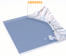 Places with similar names to San Pedro, Peru ::
Disclaimer :: Information on this page comes without warranty of any kind |
||
|
Where is San Pedro? Elevation and coordinates ::
Latitude (lat): 13°5'0"S Longitude (lon): 76°28'0"W
Elevation (approx.): -32768m (map arrows pan, magnifying glasses zoom) |
||
|
Visiting San Pedro? Hotel/Accommodation ::
Book a hotel in San Pedro Travel Guide ::
Buy a travel guide for Peru rental cars ::
car rental offers GPS waypoint ::
download a GPX waypoint (PoI) of San Pedro for your GPS receiver
|
||