|
search place name
|
||
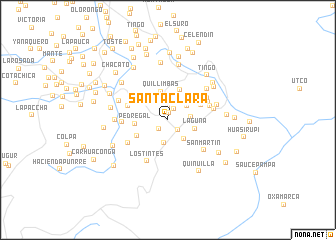
Santa Clara (Cajamarca, Peru)Santa Clara is a town in the Cajamarca region of Peru. An overview map of the region around Santa Clara is displayed below.
regional and 3d topo map of Santa Clara, Peru ::
Santa Clara airports ::
The nearest airport is CHH - Chachapoyas, located 90.1 km north east of Santa Clara.
Other airports nearby include TRU - Trujillo Capitan Carlos Martinez De Pinillos (161.7 km south west), JJI - Juanjui (162.5 km east), CIX - Chiclayo Capt Jose A Quinones Gonzales Intl (182.7 km west), TPP - Tarapoto Cadete Guillermo Del Castillo Paredes (205.9 km east), Nearby towns ::
Yerba Buena (0.8km north) //
Agua Colorada (1.4km south west) //
Rondo Cusma (1.4km north east) //
Aloacocha (1.6km north) //
Unican (1.6km south east) //
Angelo Tiana (2.5km east) //
El Triunifo (2.6km south) //
Chaclamachay (2.6km north east) //
Tondorcocha (2.8km south east) //
Laguna (3.2km east) //
Quillimbas (3.3km north) //
Les Blances (3.6km north) //
Pedregal (3.7km west) //
Laguna Seca (3.9km north west) //
Rodeo Pampa (3.9km south west) //
Sucre (4.0km north east) //
Chungrypampa (4.7km west) //
Lucma Pampa (4.9km east) //
Casha Pampa (4.9km north east) //
Chaquil (5.0km north east) //
Pajonal (5.1km west) //
Sendamal (5.1km south west) //
Los Tintes (5.2km south west) //
San Martin (5.2km south east) //
San Isidro (5.3km east) //
Tambo (5.5km north east) //
Huacapampa (5.7km east) //
Tahuan (5.8km west) //
La Nueva (5.9km west) //
[all distances 'as the bird flies' and approximate] 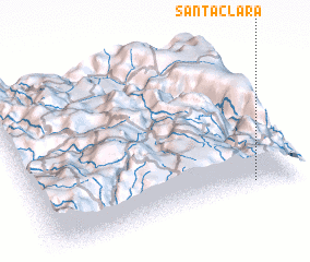 Places with similar names to Santa Clara, Peru ::
// Santa Clara (BR)
// Santa Clara (BR)
// Santa Clara (BR)
// Santa Clara (BR)
// Santa Clara (BR)
// Santa Clara (BR)
// Santa Clara (BR)
// Santa Clara (BR)
// Santa Clara (BR)
// Santa Clara (BR)
Disclaimer :: Information on this page comes without warranty of any kind |
||
|
Where is Santa Clara? Elevation and coordinates ::
Latitude (lat): 6°56'53"S Longitude (lon): 78°10'58"W
Elevation (approx.): 3166m (map arrows pan, magnifying glasses zoom) |
||
|
Visiting Santa Clara? Hotel/Accommodation ::
Book a hotel in Santa Clara Travel Guide ::
Buy a travel guide for Peru rental cars ::
car rental offers GPS waypoint ::
download a GPX waypoint (PoI) of Santa Clara for your GPS receiver
|
||