|
search place name
|
||
Santa María (Cajamarca, Peru)Santa María is a town in the Cajamarca region of Peru. An overview map of the region around Santa María is displayed below.
regional and 3d topo map of Santa María, Peru ::

Santa María airports ::
The nearest airport is CHH - Chachapoyas, located 71.4 km north east of Santa María.
Other airports nearby include CIX - Chiclayo Capt Jose A Quinones Gonzales Intl (172.5 km west), JJI - Juanjui (178.2 km east), TRU - Trujillo Capitan Carlos Martinez De Pinillos (178.9 km south west), TPP - Tarapoto Cadete Guillermo Del Castillo Paredes (210.8 km east), Nearby towns ::
Quinua Pampa Chica (1.3km north) //
Quina Pampa Chico (1.7km north) //
Huasmin (1.9km west) //
Shahuac Pampa (2.2km south east) //
San Martin (2.7km west) //
Quinuamayo (2.8km north) //
La Libertad (3.1km south west) //
El Tragadero (3.2km west) //
Palenques (3.4km south east) //
Sanchan (3.4km south east) //
Chunigan (3.5km north west) //
Chogo (4.0km north) //
Shim Pampa (4.0km west) //
Hacienda Pallar (4.3km south west) //
Granero (4.9km south) //
Buenos Aires (5.4km north west) //
Chalán (6.6km north east) //
Muyoc Cucho (6.7km north west) //
Cruz Pampa (7.1km south) //
Campana Orcco (7.3km north west) //
San Isidro (7.4km south west) //
Potrerillo (7.7km south) //
Aliso (7.9km north east) //
Rosa Pata (8.3km south east) //
Ramos Cucho (8.2km north west) //
Hacienda Callacate (8.6km south) //
Suchabamba (8.8km south) //
Sigues (9.0km south east) //
Lagunas (9.0km south west) //
[all distances 'as the bird flies' and approximate] 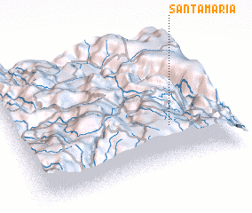 Places with similar names to Santa María, Peru ::
// Santa Maria (BR)
// Santa Maria (BR)
// Santa Maria (BR)
// Santa Maria (BR)
// Santa Maria (BR)
// Santa Maria (BR)
// Santa Maria (BR)
// Santa Maria (BR)
// Santa Maria (BR)
// Santa Maria (BR)
Disclaimer :: Information on this page comes without warranty of any kind |
||
|
Where is Santa María? Elevation and coordinates ::
Latitude (lat): 6°41'50"S Longitude (lon): 78°16'12"W
Elevation (approx.): 2974m (map arrows pan, magnifying glasses zoom) |
||
|
Visiting Santa María? Hotel/Accommodation ::
Book a hotel in Santa María Travel Guide ::
Buy a travel guide for Peru rental cars ::
car rental offers GPS waypoint ::
download a GPX waypoint (PoI) of Santa María for your GPS receiver
|
||