|
search place name
|
||
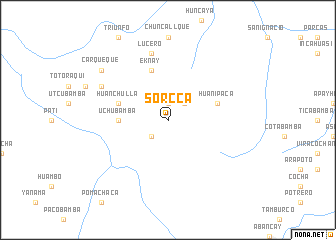
Sorcca (Apurímac, Peru)Sorcca is a town in the Apurímac region of Peru. An overview map of the region around Sorcca is displayed below.
regional and 3d topo map of Sorcca, Peru ::
Sorcca airports ::
The nearest airport is ANS - Andahuaylas, located 44.9 km south west of Sorcca.
Other airports nearby include CUZ - Cuzco Teniente Alejandro Velasco Astete Intl (113.1 km east), AYP - Ayacucho Coronel Fap Alfredo Mendivil Duarte (138.2 km west), Nearby towns ::
Tomakesca (1.9km north) //
Antaccasa (2.6km north east) //
Occopata (2.6km south west) //
Uchubamba (5.4km west) //
Huanipaca (5.7km east) //
Huanchulla (5.7km west) //
Eknay (5.8km north) //
Lucero (7.6km north) //
Tacmana (8.1km north west) //
Carqueque (9.1km north west) //
[all distances 'as the bird flies' and approximate]  Places with similar names to Sorcca, Peru ::
// Siricucu (BR)
// Suracqua (CH)
// Cerro Gago (PA)
// Sirakaíika (GR)
// Sierakówko (PL)
// Sarıkoç (TR)
// Sarıkoç (TR)
// Sirkeköy (TR)
// Sürgüç (TR)
// Sürgücü (TR)
Disclaimer :: Information on this page comes without warranty of any kind |
||
|
Where is Sorcca? Elevation and coordinates ::
Latitude (lat): 13°31'0"S Longitude (lon): 72°59'0"W
Elevation (approx.): 3893m (map arrows pan, magnifying glasses zoom) |
||
|
Visiting Sorcca? Hotel/Accommodation ::
Book a hotel in Sorcca Travel Guide ::
Buy a travel guide for Peru rental cars ::
car rental offers GPS waypoint ::
download a GPX waypoint (PoI) of Sorcca for your GPS receiver
|
||