|
search place name
|
||
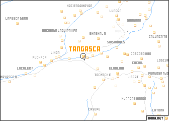
Tangasca (Cajamarca, Peru)Tangasca is a town in the Cajamarca region of Peru. An overview map of the region around Tangasca is displayed below.
regional and 3d topo map of Tangasca, Peru ::
Tangasca airports ::
The nearest airport is CIX - Chiclayo Capt Jose A Quinones Gonzales Intl, located 65.9 km south west of Tangasca.
Other airports nearby include CHH - Chachapoyas (171.8 km east), PIU - Piura Capitan Fap Guillermo Concha Iberico (186.7 km north west), TRU - Trujillo Capitan Carlos Martinez De Pinillos (191.5 km south), TYL - Talara Capitan Montes (285.9 km north west), Nearby towns ::
Pajonal (0.9km north east) //
San Martín (2.2km north east) //
Caracucho (2.5km north) //
Llaves (3.4km west) //
Luscapampa (3.5km south east) //
Shambo (3.7km north east) //
Angulis (4.0km north east) //
Naranjo (4.5km north) //
Chonta (5.1km east) //
Pirgacirca (5.1km north) //
Monte Carlo (5.6km west) //
Lajas (5.7km north west) //
Shashala (5.8km north east) //
Tocmoche (5.9km south east) //
Limón (6.3km west) //
Tres Huacas (6.4km south) //
Laquipampa (6.6km north west) //
El Campamento (7.3km west) //
Llacaden (7.5km south east) //
Hacienda Laquipampa (7.7km north west) //
Shishiques (7.7km east) //
El Molino (7.9km east) //
Tallacirca (8.2km south east) //
Huambara (8.2km east) //
La "U" (8.8km west) //
Yaque (9.0km south east) //
Zapote (9.0km north west) //
Hacienda Occhapampa (9.3km north west) //
Huayaso (9.8km north east) //
[all distances 'as the bird flies' and approximate] 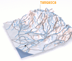 Places with similar names to Tangasca, Peru ::
// Tunguska (RU)
// Tunguska (RU)
// Tunguska (RU)
// Tunguska (RU)
// Tangasogo (BF)
// Tangassoko (BF)
// Tangazougou (BF)
// Tangséga (BF)
// Tangséga (BF)
// Tangséga (BF)
Disclaimer :: Information on this page comes without warranty of any kind |
||
|
Where is Tangasca? Elevation and coordinates ::
Latitude (lat): 6°22'27"S Longitude (lon): 79°23'58"W
Elevation (approx.): 658m (map arrows pan, magnifying glasses zoom) |
||
|
Visiting Tangasca? Hotel/Accommodation ::
Book a hotel in Tangasca Travel Guide ::
Buy a travel guide for Peru rental cars ::
car rental offers GPS waypoint ::
download a GPX waypoint (PoI) of Tangasca for your GPS receiver
|
||