|
search place name
|
||
Uñigan (Cajamarca, Peru)Uñigan is a town in the Cajamarca region of Peru. An overview map of the region around Uñigan is displayed below.
regional and 3d topo map of Uñigan, Peru ::

Uñigan airports ::
The nearest airport is CHH - Chachapoyas, located 90.1 km north east of Uñigan.
Other airports nearby include CIX - Chiclayo Capt Jose A Quinones Gonzales Intl (155.7 km west), TRU - Trujillo Capitan Carlos Martinez De Pinillos (161.8 km south west), JJI - Juanjui (191.4 km east), Nearby towns ::
Peña Blanca (1.1km east) //
Patahuasi (1.8km west) //
Hierba Buena (1.9km south west) //
Collotan (2.9km south west) //
Guagarish (3.1km north west) //
Yanacasha (3.1km west) //
Idolo (3.1km south west) //
Ulín (3.5km north) //
Pampa Caracha Bamba (3.6km north) //
Conorconga (4.3km west) //
Yacupachiac (4.3km south west) //
Ñuñún (4.8km west) //
Chileapata (5.9km north west) //
Viscacha (6.0km north) //
Piedra Redonda (6.6km south east) //
Quengorio (6.7km south) //
La Cueva (6.7km north) //
Peña Ocre (7.1km south) //
Hueco Grande (7.2km east) //
La Huayla (7.3km west) //
Poro Poro (7.3km west) //
Pampa Verde (7.4km south east) //
Rume Collpa (7.4km south west) //
Chilac (7.3km east) //
Collpa (7.4km north west) //
Puquipata (7.6km west) //
Tayamayo (7.7km west) //
Shamucate (7.9km north) //
China Linda (8.0km south) //
[all distances 'as the bird flies' and approximate] 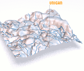 Places with similar names to Uñigan, Peru ::
Disclaimer :: Information on this page comes without warranty of any kind |
||
|
Where is Uñigan? Elevation and coordinates ::
Latitude (lat): 6°47'26"S Longitude (lon): 78°25'9"W
Elevation (approx.): 3767m (map arrows pan, magnifying glasses zoom) |
||
|
Visiting Uñigan? Hotel/Accommodation ::
Book a hotel in Uñigan Travel Guide ::
Buy a travel guide for Peru rental cars ::
car rental offers GPS waypoint ::
download a GPX waypoint (PoI) of Uñigan for your GPS receiver
|
||