|
search place name
|
||
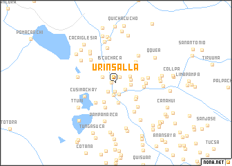
Urinsalla (Cusco, Peru)Urinsalla is a town in the Cusco region of Peru. An overview map of the region around Urinsalla is displayed below.
regional and 3d topo map of Urinsalla, Peru ::
Urinsalla airports ::
The nearest airport is CUZ - Cuzco Teniente Alejandro Velasco Astete Intl, located 81.6 km north west of Urinsalla.
Other airports nearby include JUL - Juliaca (205.7 km south east), ANS - Andahuaylas (210.5 km west), Nearby towns ::
Chilcane (0.6km north west) //
Pauchi Pampa (0.7km west) //
Pasto Grande (1.1km north east) //
Ccanchaccata (1.4km south) //
Combapata (1.8km south east) //
Chosecani (1.9km south) //
Singuña (1.9km south west) //
Ningrincancha (2.0km south) //
Isla Pampa (2.3km east) //
Tactabamba (2.3km north west) //
Ccalle (2.4km east) //
Huantura (2.5km north east) //
Iscuchaca (3.0km north) //
Pamparque (3.2km south) //
Chacamayo (3.6km south west) //
Casura (3.9km south east) //
Chacata (4.1km south east) //
Suchupucjio (4.3km south west) //
Quispi Pata (4.2km east) //
Coracora (4.4km east) //
Mosoc Llacta (4.6km south west) //
Jucuiri (4.6km north east) //
Huatucani (4.7km east) //
Patacancha (4.8km north west) //
Ccuntuma (5.2km south east) //
Culcuyre (5.1km east) //
Uchu Pampa (5.4km south east) //
Cusimachay (5.4km south west) //
Cospana (5.5km north west) //
[all distances 'as the bird flies' and approximate]  Places with similar names to Urinsalla, Peru :: Disclaimer :: Information on this page comes without warranty of any kind |
||
|
Where is Urinsalla? Elevation and coordinates ::
Latitude (lat): 14°5'28"S Longitude (lon): 71°26'34"W
Elevation (approx.): 3451m (map arrows pan, magnifying glasses zoom) |
||
|
Visiting Urinsalla? Hotel/Accommodation ::
Book a hotel in Urinsalla Travel Guide ::
Buy a travel guide for Peru rental cars ::
car rental offers GPS waypoint ::
download a GPX waypoint (PoI) of Urinsalla for your GPS receiver
|
||