|
search place name
|
||
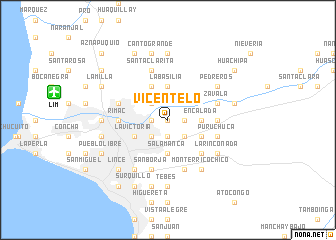
Vicentelo (Lima, Peru)Vicentelo is a town in the Lima region of Peru. An overview map of the region around Vicentelo is displayed below.
regional and 3d topo map of Vicentelo, Peru ::
Vicentelo airports ::
The nearest airport is LIM - Lima Jorge Chavez Intl, located 12.8 km west of Vicentelo.
Other airports nearby include PIO - Pisco Intl (205.7 km south east), Nearby towns ::
Bravo Chico (NaNkm north) //
Valdivieso (1.9km south) //
Menacho (1.8km west) //
Santa Rosita (1.8km east) //
Quiroz (1.8km east) //
Manzanilla (2.6km south west) //
Chacarrilla (2.6km north west) //
El Agustino (2.6km south west) //
Caja de Agua (2.6km north west) //
Santoyo (2.6km south west) //
Lurigancho (2.6km north west) //
Vásquez (2.6km south east) //
Ate (3.6km east) //
Encalada (3.6km east) //
Salamanca (3.7km south) //
La Basilia (3.7km north) //
La Victoria (4.1km south west) //
Inquisidor (4.1km south east) //
Monterrico Grande (4.1km south east) //
Flores (4.1km north west) //
Ascarrunz (4.1km north west) //
Matasango (5.2km south east) //
Camacho (5.2km south east) //
Lima (5.4km west) //
Rímac (5.4km west) //
Bravo (5.4km east) //
Asesor (5.4km east) //
Polígoño (5.7km west) //
Melgarejo (5.7km east) //
[all distances 'as the bird flies' and approximate] 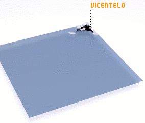 Places with similar names to Vicentelo, Peru ::
Disclaimer :: Information on this page comes without warranty of any kind |
||
|
Where is Vicentelo? Elevation and coordinates ::
Latitude (lat): 12°3'0"S Longitude (lon): 77°0'0"W
Elevation (approx.): 200m (map arrows pan, magnifying glasses zoom) |
||
|
Visiting Vicentelo? Hotel/Accommodation ::
Book a hotel in Vicentelo Travel Guide ::
Buy a travel guide for Peru rental cars ::
car rental offers GPS waypoint ::
download a GPX waypoint (PoI) of Vicentelo for your GPS receiver
|
||