|
search place name
|
||
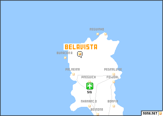
Bela Vista (Cape Verde)Bela Vista is a town in Cape Verde. An overview map of the region around Bela Vista is displayed below.
regional and 3d topo map of Bela Vista, Cape Verde ::
Bela Vista airports ::
The nearest airport is SID - Amilcar Cabral Intl, located 6.7 km south of Bela Vista.
Other airports nearby include BVC - Boa Vista Rabil (73.9 km south), SNE - Sao Nocolau Island Preguica (142.5 km west), MMO - Maio (183.8 km south), Nearby towns ::
 Places with similar names to Bela Vista, Cape Verde ::
// Belfast (JM)
// Bellavista (PE)
// Belle Vista (US)
// Bluff City (US)
// Blue Vista (US)
// Belfast (US)
// Bella Vista (US)
// Bella Vista (US)
// Bluff City (US)
// Belfast (US)
Disclaimer :: Information on this page comes without warranty of any kind |
||
|
Where is Bela Vista? Elevation and coordinates ::
Latitude (lat): 16°48'0"N Longitude (lon): 22°58'0"W
Elevation (approx.): 44m (map arrows pan, magnifying glasses zoom) |
||
|
Visiting Bela Vista? Hotel/Accommodation ::
Book a hotel in Bela Vista Travel Guide ::
Buy a travel guide for Cape Verde rental cars ::
car rental offers GPS waypoint ::
download a GPX waypoint (PoI) of Bela Vista for your GPS receiver
|
||