|
search place name
|
||
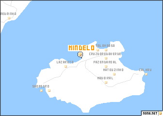
Mindelo (Cape Verde)Mindelo is a town in Cape Verde. An overview map of the region around Mindelo is displayed below.
regional and 3d topo map of Mindelo, Cape Verde ::
Mindelo airports ::
The nearest airport is VXE - Sao Vicente Island Sao Pedro, located 8.0 km south west of Mindelo.
Other airports nearby include SNE - Sao Nocolau Island Preguica (83.0 km south east), MMO - Maio (270.3 km south east), Nearby towns ::
Lazareto (4.0km south west) //
Areia Branca (4.0km north east) //
Cruz do Pé do Verde (5.3km east) //
Fazenda Real (5.6km east) //
Salamansa (5.6km east) //
Madeiral (7.7km south east) //
Mateuzinho (8.0km south east) //
Casa do Cabo Submarino (10.3km south west) //
[all distances 'as the bird flies' and approximate] 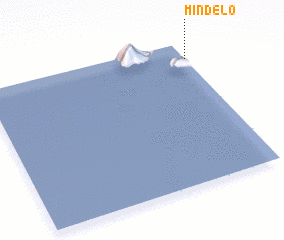 Places with similar names to Mindelo, Cape Verde ::
Disclaimer :: Information on this page comes without warranty of any kind |
||
|
Where is Mindelo? Elevation and coordinates ::
Latitude (lat): 16°53'0"N Longitude (lon): 25°0'0"W
Elevation (approx.): -32768m (map arrows pan, magnifying glasses zoom) |
||
|
Visiting Mindelo? Hotel/Accommodation ::
Book a hotel in Mindelo Travel Guide ::
Buy a travel guide for Cape Verde rental cars ::
car rental offers GPS waypoint ::
download a GPX waypoint (PoI) of Mindelo for your GPS receiver
|
||