|
search place name
|
||
Bacalao (Barinas, Venezuela)Bacalao is a town in the Barinas region of Venezuela. An overview map of the region around Bacalao is displayed below.
regional and 3d topo map of Bacalao, Venezuela ::

Bacalao airports ::
The nearest airport is GUQ - Guanare, located 33.6 km north of Bacalao.
Other airports nearby include BNS - Barinas (54.5 km west), AGV - Acarigua Oswaldo Guevara Mujica (107.0 km north east), VLV - Valera Dr Antonio Nicolas Briceno (115.5 km north west), BRM - Barquisimeto Intl (151.7 km north), Nearby towns ::
Playa del Medio (2.4km east) //
Playa Colorada (3.5km south east) //
Pueblo Nuevo (3.7km south west) //
El Rincón (4.2km south) //
San Isidro (4.3km north) //
La Funcia (5.2km north west) //
Caño Seco (6.5km north) //
Pueblo Nuevo (6.9km south) //
La Ceiba (7.1km south west) //
Poblado La Calceta (7.1km west) //
Villa Coromojo (7.2km north east) //
Madrevieja (7.2km north east) //
San Marcos (7.3km east) //
Santa Teresa (7.4km north) //
Macho Renco (8.4km north west) //
Banco Caraballero (8.6km south east) //
La Calzeta (8.9km west) //
Arauquita (8.9km east) //
San Nicolás (9.2km north) //
Rincón Mánzanillero (9.6km south west) //
Fanfurria (9.7km north west) //
Entrada de San Nicolás (10.3km north west) //
La Isla (10.4km north east) //
El Oveño (10.7km south west) //
[all distances 'as the bird flies' and approximate] 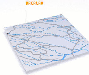 Places with similar names to Bacalao, Venezuela ::
Disclaimer :: Information on this page comes without warranty of any kind |
||
|
Where is Bacalao? Elevation and coordinates ::
Latitude (lat): 8°43'24"N Longitude (lon): 69°44'12"W
Elevation (approx.): 121m (map arrows pan, magnifying glasses zoom) |
||
|
Visiting Bacalao? Hotel/Accommodation ::
Book a hotel in Bacalao Travel Guide ::
Buy a travel guide for Venezuela rental cars ::
car rental offers GPS waypoint ::
download a GPX waypoint (PoI) of Bacalao for your GPS receiver
|
||