|
search place name
|
||
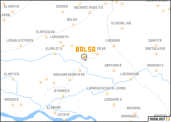
Balsa (Apure, Venezuela)Balsa is a town in the Apure region of Venezuela. An overview map of the region around Balsa is displayed below.
regional and 3d topo map of Balsa, Venezuela ::
Balsa airports ::
The nearest airport is SFD - San Fernando De Apure, located 26.0 km north east of Balsa.
Other airports nearby include PCR - Puerto Carreno (166.2 km south), VDP - Valle De La Pascua (243.1 km north east), AGV - Acarigua Oswaldo Guevara Mujica (276.2 km north west), Nearby towns ::
Damuncito (2.4km south west) //
Santa Rosa (2.9km north east) //
El Chigüire (4.6km north west) //
San Juan de Payara (5.4km south west) //
Los Valentones (6.0km north west) //
Santa Ana (6.5km east) //
La Piedrita (6.8km north west) //
El Palote (6.9km west) //
La Guama (7.0km north east) //
Zamorita (8.4km south west) //
Belén (8.4km north) //
La Mangas Castilleras (8.4km south east) //
Atamaica (9.1km south west) //
Payara (9.4km south west) //
El Pescado (10.1km north west) //
El Remolino (10.7km north east) //
[all distances 'as the bird flies' and approximate] 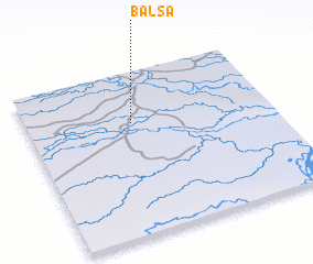 Places with similar names to Balsa, Venezuela ::
Disclaimer :: Information on this page comes without warranty of any kind |
||
|
Where is Balsa? Elevation and coordinates ::
Latitude (lat): 7°41'8"N Longitude (lon): 67°34'20"W
Elevation (approx.): 50m (map arrows pan, magnifying glasses zoom) |
||
|
Visiting Balsa? Hotel/Accommodation ::
Book a hotel in Balsa Travel Guide ::
Buy a travel guide for Venezuela rental cars ::
car rental offers GPS waypoint ::
download a GPX waypoint (PoI) of Balsa for your GPS receiver
|
||