|
search place name
|
||
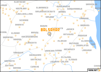
Balsamar (Falcón, Venezuela)Balsamar is a town in the Falcón region of Venezuela. An overview map of the region around Balsamar is displayed below.
regional and 3d topo map of Balsamar, Venezuela ::
Balsamar airports ::
The nearest airport is LSP - Paraguana Josefa Camejo, located 22.3 km south west of Balsamar.
Other airports nearby include CZE - Coro Jose Leonardo Chirinos (58.1 km south east), AUA - Oranjestad Reina Beatrix Intl (71.1 km north), CUR - Willemstad Hato (115.2 km east), BON - Kralendijk Flamingo (187.0 km east), Nearby towns ::
Guacurebo (2.2km south east) //
La Bomba (2.9km south) //
Los Llanitos (3.1km south west) //
Buena Vista (3.2km north east) //
Misaray (3.5km east) //
Adaure (3.8km north west) //
Cujisal (3.9km east) //
Moruy (4.1km south west) //
Pilancón (5.0km south east) //
Jarayadito (5.9km south west) //
Barunú (5.8km west) //
San José (6.2km north) //
La Ciénega (6.4km north east) //
Campo Alegre (6.4km north) //
Varacara (6.4km south) //
San Nicolás (6.5km south west) //
Matividiro (6.5km east) //
Siraba (6.9km south east) //
Santa Aria (7.1km south) //
Barlovento (7.1km south) //
Jariaca (7.3km east) //
Tumarusa (7.5km south) //
Rincón de Baruno (7.6km west) //
La Negrita (7.7km south west) //
La Vigía (8.1km north) //
Las Virtudes (8.1km north) //
El Yacural (8.1km north west) //
Tacaduto (8.2km west) //
San José de Cocodite (8.4km north) //
[all distances 'as the bird flies' and approximate]  Places with similar names to Balsamar, Venezuela ::
Disclaimer :: Information on this page comes without warranty of any kind |
||
|
Where is Balsamar? Elevation and coordinates ::
Latitude (lat): 11°51'38"N Longitude (lon): 69°57'50"W
Elevation (approx.): 98m (map arrows pan, magnifying glasses zoom) |
||
|
Visiting Balsamar? Hotel/Accommodation ::
Book a hotel in Balsamar Travel Guide ::
Buy a travel guide for Venezuela rental cars ::
car rental offers GPS waypoint ::
download a GPX waypoint (PoI) of Balsamar for your GPS receiver
|
||