|
search place name
|
||
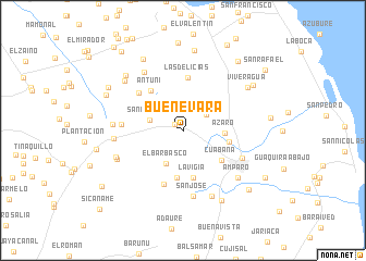
Buenevara (Falcón, Venezuela)Buenevara is a town in the Falcón region of Venezuela. An overview map of the region around Buenevara is displayed below.
regional and 3d topo map of Buenevara, Venezuela ::
Buenevara airports ::
The nearest airport is LSP - Paraguana Josefa Camejo, located 29.0 km south west of Buenevara.
Other airports nearby include AUA - Oranjestad Reina Beatrix Intl (58.1 km north), CZE - Coro Jose Leonardo Chirinos (70.0 km south east), CUR - Willemstad Hato (113.1 km east), BON - Kralendijk Flamingo (186.7 km east), Nearby towns ::
La Sirena (1.0km north west) //
Cayerúa (2.9km north east) //
San Antonio (3.6km west) //
El Barbasco (3.8km south west) //
Azaro (4.2km east) //
San José de Cocodite (4.9km south) //
Chunaure (4.8km east) //
Cuabana (4.9km south east) //
Las Virtudes (5.0km south) //
La Vigía (5.0km south) //
Antuni (5.2km north west) //
Las Delicias (5.5km north) //
El Yacural (5.8km south) //
El Centenario (5.9km north west) //
Caradocagua (6.3km west) //
Pueblo Nuevo (6.6km south east) //
San José (6.8km south) //
La Selva (7.0km west) //
San Joaquín (7.1km north west) //
La Correría (7.0km west) //
Campo Alegre (7.3km south east) //
Santa Inés (7.3km south west) //
Santa Inés (7.3km west) //
Amparo (7.4km south east) //
Punta de Cuestión (7.7km north west) //
Viveragua (7.8km north east) //
Chivuche (8.1km north west) //
La Ciénega (8.2km south east) //
El Doral (8.3km north) //
[all distances 'as the bird flies' and approximate] 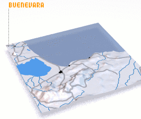 Places with similar names to Buenevara, Venezuela ::
// Bou Anfer (MA)
// Ban Ao Phra (TH)
// Ban Fao Rai (TH)
// Ban Fao Rai (TH)
// Ban Fao Rai (TH)
// Ban Nai Phru (TH)
// Ban Na Phra (TH)
// Ban Na Phrai (TH)
// Ban Na Phrai (TH)
// Ban Na Phrao (TH)
Disclaimer :: Information on this page comes without warranty of any kind |
||
|
Where is Buenevara? Elevation and coordinates ::
Latitude (lat): 11°58'39"N Longitude (lon): 69°58'34"W
Elevation (approx.): 115m (map arrows pan, magnifying glasses zoom) |
||
|
Visiting Buenevara? Hotel/Accommodation ::
Book a hotel in Buenevara Travel Guide ::
Buy a travel guide for Venezuela rental cars ::
car rental offers GPS waypoint ::
download a GPX waypoint (PoI) of Buenevara for your GPS receiver
|
||