|
search place name
|
||
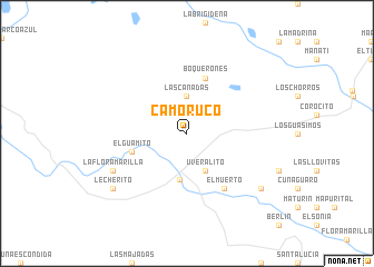
Camoruco (Barinas, Venezuela)Camoruco is a town in the Barinas region of Venezuela. An overview map of the region around Camoruco is displayed below.
regional and 3d topo map of Camoruco, Venezuela ::
Camoruco airports ::
The nearest airport is SFD - San Fernando De Apure, located 133.8 km south east of Camoruco.
Other airports nearby include AGV - Acarigua Oswaldo Guevara Mujica (145.5 km north west), GUQ - Guanare (150.5 km north west), BNS - Barinas (188.6 km west), VLN - Valencia Arturo Michelena Intl (198.8 km north), Nearby towns ::
Las Cañadas (3.7km north) //
Uveralito (4.1km south east) //
La Providencia (4.7km south) //
El Guamito (5.8km west) //
Boquerones (5.9km north) //
El Muerto (6.7km south east) //
La Flor Amarilla (8.2km south west) //
Lecherito (9.2km south west) //
Caujarito (9.2km south east) //
[all distances 'as the bird flies' and approximate] 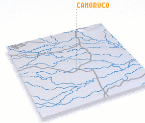 Places with similar names to Camoruco, Venezuela ::
Disclaimer :: Information on this page comes without warranty of any kind |
||
|
Where is Camoruco? Elevation and coordinates ::
Latitude (lat): 8°27'0"N Longitude (lon): 68°31'0"W
Elevation (approx.): 70m (map arrows pan, magnifying glasses zoom) |
||
|
Visiting Camoruco? Hotel/Accommodation ::
Book a hotel in Camoruco Travel Guide ::
Buy a travel guide for Venezuela rental cars ::
car rental offers GPS waypoint ::
download a GPX waypoint (PoI) of Camoruco for your GPS receiver
|
||