|
search place name
|
||
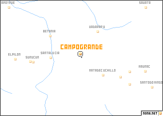
Campo Grande (Bolívar, Venezuela)Campo Grande is a town in the Bolívar region of Venezuela. An overview map of the region around Campo Grande is displayed below.
regional and 3d topo map of Campo Grande, Venezuela ::
Campo Grande airports ::
The nearest airport is BVB - Boa Vista, located 207.3 km south of Campo Grande.
Other airports nearby include LTM - Lethem (218.1 km south east), CAJ - Canaima (247.2 km north west), Nearby towns ::
Mata de Cuchillo (6.4km south east) //
Santa Lucía (7.0km west) //
Uadaparú (7.1km north east) //
Betania (8.8km north west) //
[all distances 'as the bird flies' and approximate] 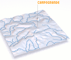 Places with similar names to Campo Grande, Venezuela ::
// Camp Ground (US)
// Campground (US)
// Camp Ground (US)
// Camp Ground (US)
// Campo Grande (PT)
// Campo Grande (PT)
// Camp Ground (US)
// Camp Ground (US)
// Campo Grande (MX)
// Campo Grande (VE)
Disclaimer :: Information on this page comes without warranty of any kind |
||
|
Where is Campo Grande? Elevation and coordinates ::
Latitude (lat): 4°36'44"N Longitude (lon): 61°19'0"W
Elevation (approx.): 1009m (map arrows pan, magnifying glasses zoom) |
||
|
Visiting Campo Grande? Hotel/Accommodation ::
Book a hotel in Campo Grande Travel Guide ::
Buy a travel guide for Venezuela rental cars ::
car rental offers GPS waypoint ::
download a GPX waypoint (PoI) of Campo Grande for your GPS receiver
|
||