|
search place name
|
||
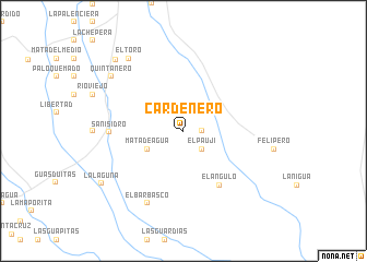
Cardenero (Cojedes, Venezuela)Cardenero is a town in the Cojedes region of Venezuela. An overview map of the region around Cardenero is displayed below.
regional and 3d topo map of Cardenero, Venezuela ::
Cardenero airports ::
The nearest airport is AGV - Acarigua Oswaldo Guevara Mujica, located 71.2 km west of Cardenero.
Other airports nearby include SFH - San Felipe Sub Teniente Nestor Arias (102.0 km north), BRM - Barquisimeto Intl (110.5 km north west), VLN - Valencia Arturo Michelena Intl (114.9 km north east), GUQ - Guanare (130.6 km west), Nearby towns ::
Montes de Oca (1.8km east) //
El Paují (2.6km south east) //
Mata de Agua (4.1km south west) //
El Ángulo (6.7km south east) //
San Isidro (7.5km west) //
El Barbasco (8.3km south west) //
El Toro (9.2km north west) //
El Pajón (9.2km north west) //
Quintanero (9.2km north west) //
La Laguna (9.8km south west) //
El Muertico (10.0km north west) //
[all distances 'as the bird flies' and approximate] 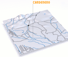 Places with similar names to Cardenero, Venezuela ::
Disclaimer :: Information on this page comes without warranty of any kind |
||
|
Where is Cardenero? Elevation and coordinates ::
Latitude (lat): 9°22'0"N Longitude (lon): 68°37'0"W
Elevation (approx.): 90m (map arrows pan, magnifying glasses zoom) |
||
|
Visiting Cardenero? Hotel/Accommodation ::
Book a hotel in Cardenero Travel Guide ::
Buy a travel guide for Venezuela rental cars ::
car rental offers GPS waypoint ::
download a GPX waypoint (PoI) of Cardenero for your GPS receiver
|
||