|
search place name
|
||
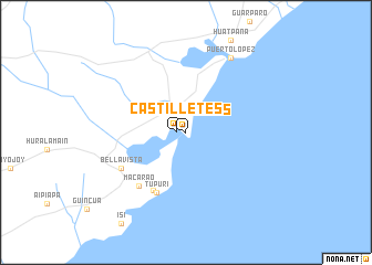
Castilletes (Zulia, Venezuela)Castilletes is a town in the Zulia region of Venezuela. An overview map of the region around Castilletes is displayed below.
regional and 3d topo map of Castilletes, Venezuela ::
Castilletes airports ::
The nearest airport is LSP - Paraguana Josefa Camejo, located 128.0 km east of Castilletes.
Other airports nearby include MAR - Maracaibo La Chinita Intl (149.4 km south), AUA - Oranjestad Reina Beatrix Intl (159.7 km north east), RCH - Rio Hacha Almirante Padilla (178.2 km west), CZE - Coro Jose Leonardo Chirinos (185.5 km east), Nearby towns ::
Castilletes (1.0km west) //
Makaraipaho (3.4km north west) //
Tápuri (6.6km south west) //
Tupuri (6.7km south west) //
Macarao (7.1km south west) //
Bella Vista (7.4km south west) //
Puerto López (8.7km north east) //
[all distances 'as the bird flies' and approximate] 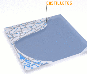 Places with similar names to Castilletes, Venezuela ::
// Güstelitz (DE)
// Castel Tasso (IT)
// Kastolatsi (EE)
// Gostilitsa (BG)
// Gostilitsy (RU)
// Casa de Altos (MX)
// Castilletes (CO)
// Costeilades (FR)
Disclaimer :: Information on this page comes without warranty of any kind |
||
|
Where is Castilletes? Elevation and coordinates ::
Latitude (lat): 11°50'57"N Longitude (lon): 71°19'28"W
(map arrows pan, magnifying glasses zoom) |
||
|
Visiting Castilletes? Hotel/Accommodation ::
Book a hotel in Castilletes Travel Guide ::
Buy a travel guide for Venezuela rental cars ::
car rental offers GPS waypoint ::
download a GPX waypoint (PoI) of Castilletes for your GPS receiver
|
||